
Mynd:Plan de Paris en 1657.JPG

Stærð þessarar forskoðunar: 716 × 599 mynddílar Aðrar upplausnir: 287 × 240 mynddílar | 573 × 480 mynddílar | 917 × 768 mynddílar | 1.223 × 1.024 mynddílar | 2.446 × 2.048 mynddílar | 5.500 × 4.605 mynddílar.
Upphafleg skrá (5.500 × 4.605 mynddílar, skráarstærð: 17,62 MB, MIME-gerð: image/jpeg)
Lýsing
| Titill |
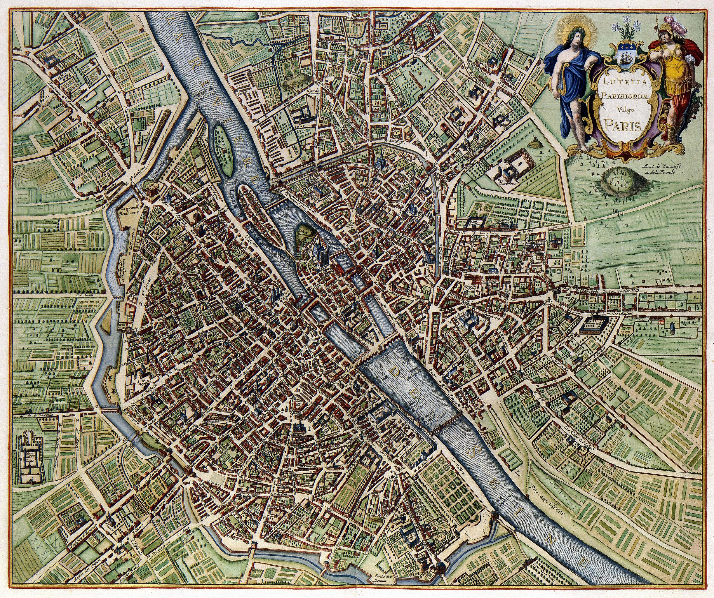
Lutetia Parisiorum vulgo Paris |
|||||||||||||||||||||||||
| Description | ||||||||||||||||||||||||||
| Dagsetning | published in 1657, the map depicts Paris as it appeared sometime after 1638 but before 1652 (see Talk page) | |||||||||||||||||||||||||
| Uppruni | Geheugen van Nederland | |||||||||||||||||||||||||
| Skapari |
|
|||||||||||||||||||||||||
| Geotemporal data | ||||||||||||||||||||||||||
| Bounding box |
|
|||||||||||||||||||||||||
| Georeferencing | ||||||||||||||||||||||||||
| Object location | | View this and other nearby images on: OpenStreetMap |
|---|
Assessment
|
This image was selected as picture of the day on Wikimedia Commons for 21 May 2011. It was captioned as follows:
|
This digital media file - and/or the physical objects depicted on it - originates from the digital and/or physical collections of the Koninklijke Bibliotheek, national library of the Netherlands.
|
Leyfisupplýsingar:
|
This is a faithful photographic reproduction of a two-dimensional, public domain work of art. The work of art itself is in the public domain for the following reason:
The official position taken by the Wikimedia Foundation is that "faithful reproductions of two-dimensional public domain works of art are public domain".
This photographic reproduction is therefore also considered to be in the public domain in the United States. In other jurisdictions, re-use of this content may be restricted; see Reuse of PD-Art photographs for details. | ||||
Breytingaskrá skjals
Smelltu á dagsetningu eða tímasetningu til að sjá hvernig hún leit þá út.
| Dagsetning/Tími | Smámynd | Víddir | Notandi | Athugasemd | |
|---|---|---|---|---|---|
| núverandi | 18. febrúar 2010 kl. 08:12 | | 5.500 × 4.605 (17,62 MB) | Thesupermat | {{Information |Description={{fr|1=Plan de Paris par Johannes Janssonius }} |Source=http://www.geheugenvannederland.nl/?/nl/items/KONB01:259/&st=Parijs&sc=(Parijs)+AND+(isPartOf+any+%22KONB01%22+) |Author=Johannes Janssonius |Date=1657 |Permission= |othe |
Skráartenglar
Það eru engar síður sem nota þessa skrá.
Altæk notkun skráar
Eftirfarandi wikar nota einnig þessa skrá:
- Notkun á ba.wikipedia.org
- Notkun á be-tarask.wikipedia.org
- Notkun á bn.wikipedia.org
- Notkun á ca.wikipedia.org
- Notkun á crh.wikipedia.org
- Notkun á cv.wikipedia.org
- Notkun á da.wikipedia.org
- Notkun á el.wikipedia.org
- Notkun á en.wikipedia.org
- Notkun á fr.wikipedia.org
- Notkun á fy.wikipedia.org
- Notkun á hr.wikipedia.org
- Notkun á hu.wikipedia.org
- Notkun á ko.wikipedia.org
- Notkun á lbe.wikipedia.org
- Notkun á lb.wikipedia.org
- Notkun á mg.wikipedia.org
- Notkun á nl.wikipedia.org
- Notkun á os.wikipedia.org
- Notkun á pl.wikipedia.org
- Notkun á pt.wikipedia.org
- Notkun á ru.wikipedia.org
- Notkun á ru.wikinews.org
- Notkun á sah.wikipedia.org
- Notkun á su.wikipedia.org
- Notkun á sv.wikipedia.org
- Notkun á uk.wikipedia.org
- Notkun á ur.wikipedia.org
- Notkun á vi.wikipedia.org
- Notkun á xal.wikipedia.org
- Notkun á zh.wikipedia.org
Skoða frekari altæka notkun þessarar skráar.