
Mynd:New Zealand provinces.png
Það er engin hærri upplausn til.
New_Zealand_provinces.png (405 × 590 mynddílar, skráarstærð: 5 KB, MIME-gerð: image/png)
Lýsing

|
This locator map image could be re-created using vector graphics as an SVG file. This has several advantages; see Commons:Media for cleanup for more information. If an SVG form of this image is available, please upload it and afterwards replace this template with
{{vector version available|new image name}}.
It is recommended to name the SVG file “New Zealand provinces.svg”—then the template Vector version available (or Vva) does not need the new image name parameter. |

|
This map has been uploaded by Electionworld from en.wikipedia.org to enable the |
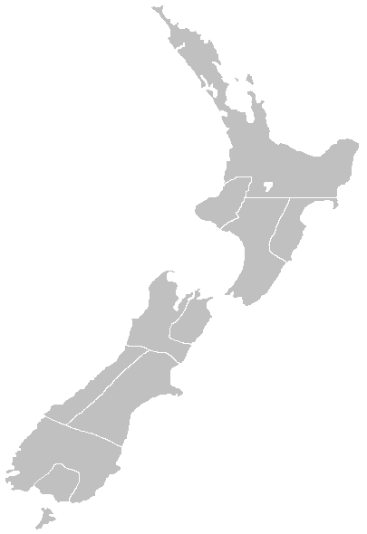
Map of the former Provinces of New Zealand, by myself.
Leyfisupplýsingar:
I, the copyright holder of this work, hereby publish it under the following licenses:

|
Gefið er leyfi til að afrita, dreifa og/eða breyta þessu skjali samkvæmt Frjálsa GNU Free Documentation License, útgáfu 1.2 eða nýrri, sem gefið er út af Frjálsu hugbúnaðarstofnuninni með engum breytingum þar á. Afrit af leyfinu er innifalið í kaflanum GNU Free Documentation License. |
| Þessi skrá er með Creative Commons Tilvísun-DeilaEins 3.0 Óstaðfært notkunarleyfi. | ||
| ||
| This licensing tag was added to this file as part of the GFDL licensing update. |
Þú mátt velja notkunarleyfi að eigin vali.
Original work by en:user:LJ Holden
derivative works
Derivative works of this file:
- New Zealand New Munster 1846.PNG
- New Zealand provinces 1852.png
- New Zealand provinces Auckland.png
- New Zealand provinces Canterbury.png
- New Zealand provinces Hawkes Bay.png
- New Zealand province Marlborough.png
- New Zealand provinces Marlborough.png
- New Zealand provinces Nelson.png
- New Zealand provinces Otago.png
- New Zealand provinces Taranaki.png
- New Zealand provinces Wellington.png
Breytingaskrá skjals
Smelltu á dagsetningu eða tímasetningu til að sjá hvernig hún leit þá út.
| Dagsetning/Tími | Smámynd | Víddir | Notandi | Athugasemd | |
|---|---|---|---|---|---|
| núverandi | 29. nóvember 2006 kl. 23:11 | | 405 × 590 (5 KB) | Electionworld | {{ew|en||holden}} Map of the former Provinces of New Zealand, by myself. == Licensing == {{GFDL-self}} Category:Maps of New Zealand |
Skráartenglar
Það eru engar síður sem nota þessa skrá.
Altæk notkun skráar
Eftirfarandi wikar nota einnig þessa skrá:
- Notkun á en.wikibooks.org
- Notkun á es.wikipedia.org
- Notkun á fr.wikipedia.org
- Notkun á pt.wikipedia.org
- Notkun á pt.wikibooks.org