
Mynd:Mitiaro Island map.jpg
Stærð þessarar forskoðunar: 800 × 582 mynddílar Aðrar upplausnir: 320 × 233 mynddílar | 640 × 466 mynddílar | 1.024 × 745 mynddílar | 1.240 × 902 mynddílar.
Upphafleg skrá (1.240 × 902 mynddílar, skráarstærð: 200 KB, MIME-gerð: image/jpeg)

|
This map image could be re-created using vector graphics as an SVG file. This has several advantages; see Commons:Media for cleanup for more information. If an SVG form of this image is available, please upload it and afterwards replace this template with
{{vector version available|new image name}}.
It is recommended to name the SVG file “Mitiaro Island map.svg”—then the template Vector version available (or Vva) does not need the new image name parameter. |


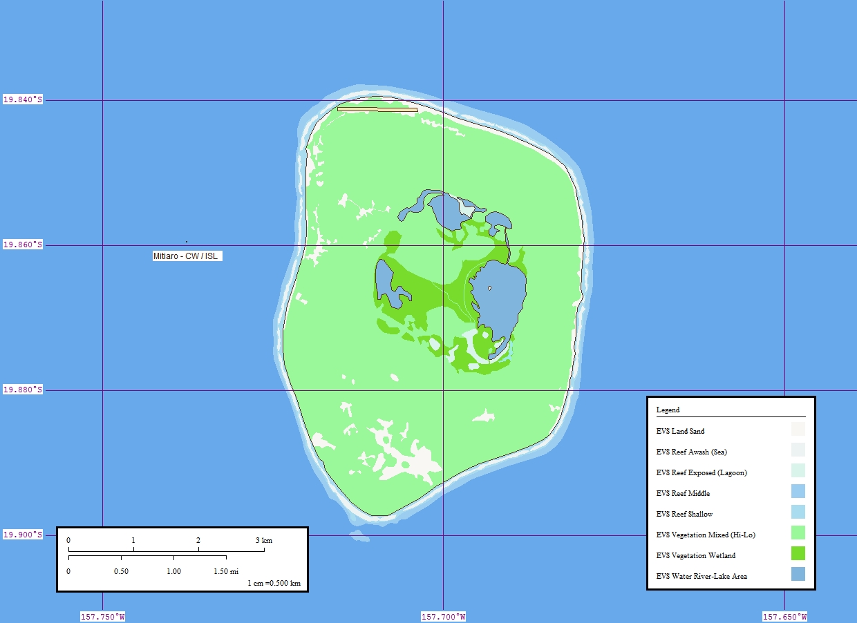
| Lýsing | Map of Mitiaro Island, Cook Islands | ||
| Dagsetning | |||
| Uppruni | Flickr | ||
| Höfundarréttarhafi | EVS-Islands | ||
| Réttindi (Endurnotkun á þessari skrá) |
This file is licensed under the Creative Commons Attribution 2.0 Generic license.
|
Breytingaskrá skjals
Smelltu á dagsetningu eða tímasetningu til að sjá hvernig hún leit þá út.
| Dagsetning/Tími | Smámynd | Víddir | Notandi | Athugasemd | |
|---|---|---|---|---|---|
| núverandi | 14. október 2006 kl. 19:20 | | 1.240 × 902 (200 KB) | Vriullop | {{Information |Description=Map of Mitiaro Island, Cook Islands |Source=[http://www.flickr.com/photos/evsmap/125987540/ Flickr] |Date=9 April 2006 |Author=[http://www.flickr.com/photos/evsmap/ EVS-Islands] |Permission={{cc-by-2.0}} |other_versions= }} [[C |
Skráartenglar
Eftirfarandi síða notar þessa skrá:
Altæk notkun skráar
Eftirfarandi wikar nota einnig þessa skrá:
- Notkun á ca.wikipedia.org
- Notkun á cs.wikipedia.org
- Notkun á de.wikipedia.org
- Notkun á en.wikipedia.org
- Notkun á es.wikipedia.org
- Notkun á fi.wikipedia.org
- Notkun á fr.wikipedia.org
- Notkun á id.wikipedia.org
- Notkun á it.wikipedia.org
- Notkun á ka.wikipedia.org
- Notkun á la.wikipedia.org
- Notkun á lt.wikipedia.org
- Notkun á mt.wikipedia.org
- Notkun á pl.wikipedia.org
- Notkun á ru.wikipedia.org
- Notkun á su.wikipedia.org
- Notkun á sv.wikipedia.org
- Notkun á tr.wikipedia.org