
Mynd:Italian social republic map.png
Stærð þessarar forskoðunar: 577 × 600 mynddílar Aðrar upplausnir: 231 × 240 mynddílar | 462 × 480 mynddílar | 983 × 1.022 mynddílar.
Upphafleg skrá (983 × 1.022 mynddílar, skráarstærð: 71 KB, MIME-gerð: image/png)
Lýsing
| Lýsing |
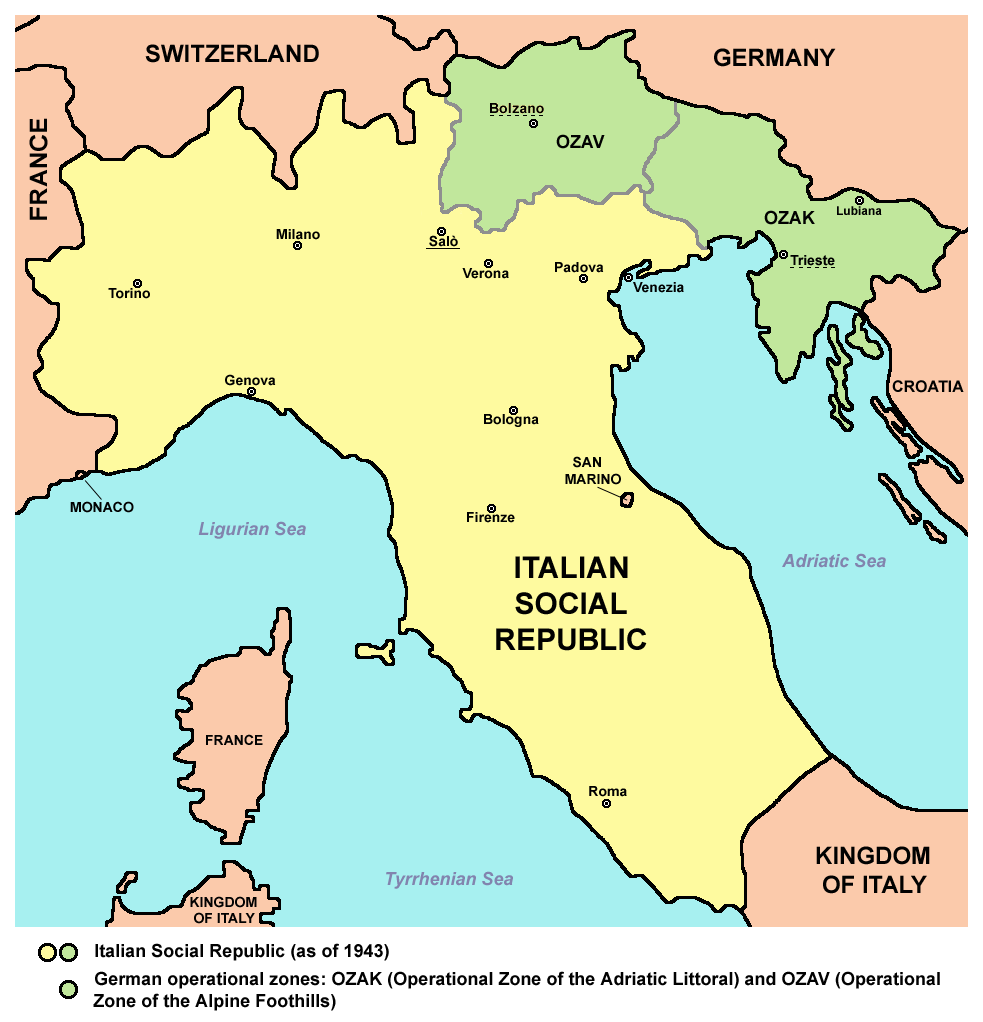
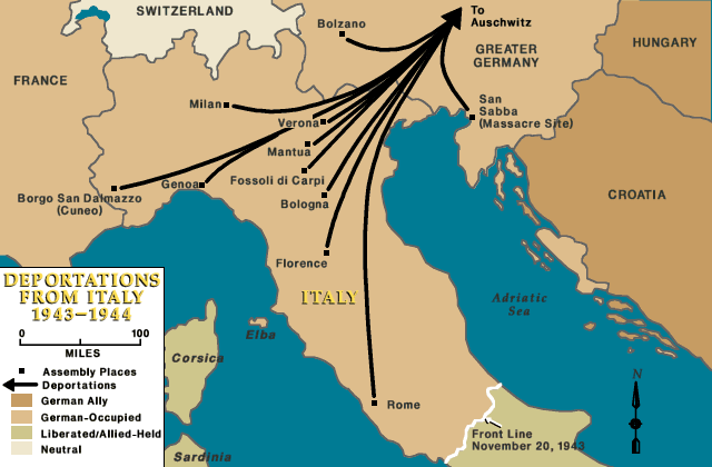
English: Map of the Italian Social Republic (as of 1943) |
| Dagsetning | |
| Uppruni | eigin skrá |
| Höfundarréttarhafi | PANONIAN |
| Aðrar útgáfur |
[]
|
.png)


Leyfisupplýsingar:
I, the copyright holder of this work, hereby publish it under the following license:
| This file is made available under the Creative Commons CC0 1.0 Universal Public Domain Dedication. | |
| The person who associated a work with this deed has dedicated the work to the public domain by waiving all of their rights to the work worldwide under copyright law, including all related and neighboring rights, to the extent allowed by law. You can copy, modify, distribute and perform the work, even for commercial purposes, all without asking permission.
|
References
- http://fop-historyclan.ucoz.de/Bilder/Karten/Karte_I_4345.jpg
- http://www.popescugalle.com/RSI/RSICARTINA.JPG
- http://www.tusciaromana.info/3CulturaImmagini/Storia/RSI/34RSICarta-302x302.gif
- http://www.storia900bivc.it/pagine/roncarolo/images/cartinasalo.jpg
- http://t1.gstatic.com/images?q=tbn:ANd9GcTxus3yiEpwjN8spDTMmjWiGhgH0igEp6n-jMMgyUf-1_oPZeOfzFbRt3_r
- http://www.cdec.it/public/campi_titolo.jpg
- http://www.italia-resistenza.it/wp-content/uploads/2012/02/censimento-rsi-e1329910374490-150x150.png
- http://www.euratlas.net/history/hisatlas/balkan_states/194538BK.jpg
- http://4.bp.blogspot.com/-TefvgbFW6No/TWKmKHEbbNI/AAAAAAAAAEk/ik8Fg_ONN7A/s1600/cartina2_piccola.jpg
- http://www.ushmm.org/lcmedia/map/lc/image/ita76030.gif
- http://www.worldology.com/Europe/images/wwii_1943_italy2.jpg
- http://imageshack.us/photo/my-images/183/ndh19431945wa5.png/
- http://win.liceoamaldi.it/didattica/Resistenza_Italia_Bergamo/immagini/cartina1_piccola.jpg
- http://www.storiaxxisecolo.it/secondaguerra/liberazione.jpg
- http://seconda-guerra-mondiale.historiaweb.net/img/cartina-liberazione-italia.jpg
- http://www.ushmm.org/lcmedia/map/lc/image/ita78110.gif
Breytingaskrá skjals
Smelltu á dagsetningu eða tímasetningu til að sjá hvernig hún leit þá út.
| Dagsetning/Tími | Smámynd | Víddir | Notandi | Athugasemd | |
|---|---|---|---|---|---|
| núverandi | 18. ágúst 2015 kl. 12:23 | | 983 × 1.022 (71 KB) | Foghe | Bolzano and other particulars. |
| 2. desember 2012 kl. 22:14 |  | 983 × 1.022 (82 KB) | PANONIAN | Reverted to version as of 17:17, 16 November 2012 - you two please upload your maps under different file name | |
| 2. desember 2012 kl. 21:30 |  | 952 × 912 (55 KB) | Hazhk | Remove big block of text - add first note to the article | |
| 2. desember 2012 kl. 20:16 |  | 983 × 1.107 (142 KB) | R-41~commonswiki | Corrections to borders. Notes on borders at bottom. | |
| 16. nóvember 2012 kl. 17:17 |  | 983 × 1.022 (82 KB) | PANONIAN | {{Information |Description=Map of the Italian Social Republic (as of 1943) |Source={{own}} |Date=2012 |Author= PANONIAN |Permission= |other_versions= }} |
Skráartenglar
Eftirfarandi síða notar þessa skrá:
Altæk notkun skráar
Eftirfarandi wikar nota einnig þessa skrá:
- Notkun á arz.wikipedia.org
- Notkun á ast.wikipedia.org
- Notkun á azb.wikipedia.org
- Notkun á az.wikipedia.org
- Notkun á be-tarask.wikipedia.org
- Notkun á be.wikipedia.org
- Notkun á bg.wikipedia.org
- Notkun á bs.wikipedia.org
- Notkun á ca.wikipedia.org
- Notkun á cs.wikipedia.org
- Notkun á cv.wikipedia.org
- Notkun á da.wikipedia.org
- Notkun á el.wikipedia.org
- Notkun á en.wikipedia.org
- Notkun á eo.wikipedia.org
- Notkun á es.wikipedia.org
- Notkun á fa.wikipedia.org
- Notkun á fi.wikipedia.org
- Notkun á gl.wikipedia.org
- Notkun á he.wikipedia.org
- Notkun á hr.wikipedia.org
- Notkun á hu.wikipedia.org
- Notkun á id.wikipedia.org
- Notkun á it.wikipedia.org
- Notkun á ja.wikipedia.org
- Notkun á jv.wikipedia.org
- Notkun á ko.wikipedia.org
- Notkun á la.wikipedia.org
- Notkun á nl.wikipedia.org
- Notkun á no.wikipedia.org
- Notkun á pl.wikipedia.org
- Notkun á pnb.wikipedia.org
- Notkun á pt.wikipedia.org
- Notkun á ro.wikipedia.org
Skoða frekari altæka notkun þessarar skráar.