
Mynd:Historisch Nordamerika.jpg
Stærð þessarar forskoðunar: 731 × 600 mynddílar Aðrar upplausnir: 293 × 240 mynddílar | 585 × 480 mynddílar | 936 × 768 mynddílar | 1.248 × 1.024 mynddílar | 2.497 × 2.048 mynddílar | 2.560 × 2.100 mynddílar.
Upphafleg skrá (2.560 × 2.100 mynddílar, skráarstærð: 6,03 MB, MIME-gerð: image/jpeg)
Lýsing
| Lýsing |
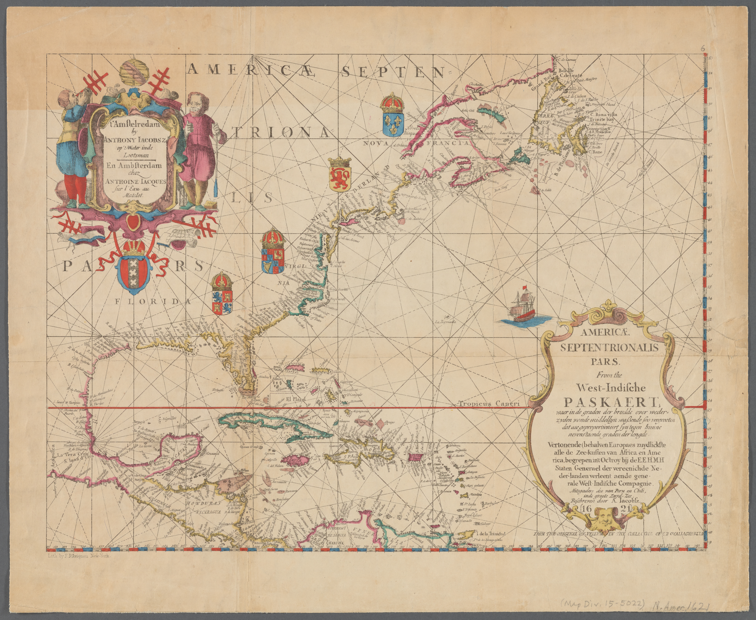
English: Old map of North America, the Caribbean, and northern South America; covers area north from Venezuela to Labrador; includes decorative cartouches and illustrations. This is a facsimile, from the original on vellum in the collection of E.B. O'Callaghan LLD.
|
||
| Dagsetning | |||
| Uppruni |
|
||
| Höfundarréttarhafi |
Anthoni Jacobsz (1594-1624), cartographer Francis D'Avignon (1813–1875), lithographer E.B. (Edmund Bailey) O'Callaghan (1797–1880), collector |
||
| Aðrar útgáfur |
|
.jpg)

.jpg)
Leyfisupplýsingar:
|
This work is in the public domain in its country of origin and other countries and areas where the copyright term is the author's life plus 100 years or fewer. This work is in the public domain in the United States because it was published (or registered with the U.S. Copyright Office) before January 1, 1929. | |
| This file has been identified as being free of known restrictions under copyright law, including all related and neighboring rights. | |
Breytingaskrá skjals
Smelltu á dagsetningu eða tímasetningu til að sjá hvernig hún leit þá út.
| Dagsetning/Tími | Smámynd | Víddir | Notandi | Athugasemd | |
|---|---|---|---|---|---|
| núverandi | 10. janúar 2021 kl. 23:55 | | 2.560 × 2.100 (6,03 MB) | Vzeebjtf | larger, higher resolution |
| 13. september 2013 kl. 21:43 |  | 400 × 314 (83 KB) | Gladiool | Same image, higher quality. | |
| 2. október 2005 kl. 20:14 |  | 382 × 269 (38 KB) | Newsflash | 16 or 17 century old map |
Skráartenglar
Það eru engar síður sem nota þessa skrá.
Altæk notkun skráar
Eftirfarandi wikar nota einnig þessa skrá:
- Notkun á bn.wikipedia.org
- Notkun á ka.wikipedia.org
- Notkun á km.wikipedia.org