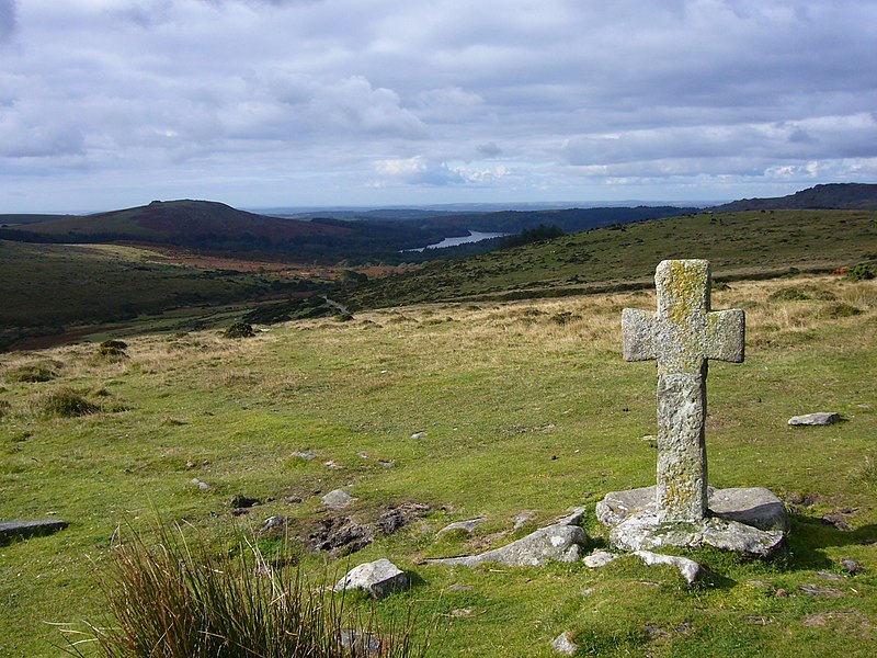
Mynd:Crazywell cross 1.JPG
Útlit

Stærð þessarar forskoðunar: 800 × 600 mynddílar Aðrar upplausnir: 320 × 240 mynddílar | 640 × 480 mynddílar | 1.024 × 768 mynddílar | 1.280 × 960 mynddílar | 2.048 × 1.536 mynddílar.
Upphafleg skrá (2.048 × 1.536 mynddílar, skráarstærð: 1,42 MB, MIME-gerð: image/jpeg)
Breytingaskrá skjals
Smelltu á dagsetningu eða tímasetningu til að sjá hvernig hún leit þá út.
| Dagsetning/Tími | Smámynd | Víddir | Notandi | Athugasemd | |
|---|---|---|---|---|---|
| núverandi | 1. október 2008 kl. 10:05 |  | 2.048 × 1.536 (1,42 MB) | Herbythyme | {{Information| |Description = Ancient cross close to Crazywell Pool on southern Dartmoor. It may well have been used as a marker for the track from the monastery at Buckfast to the monastery at Tavistock. |Source = self-made |Date = c |
Skráartenglar
Það eru engar síður sem nota þessa skrá.
Altæk notkun skráar
Eftirfarandi wikar nota einnig þessa skrá:
- Notkun á bg.wikipedia.org
- Notkun á bn.wikipedia.org
- Notkun á crh.wikipedia.org
- Notkun á cv.wikipedia.org
- Notkun á en.wikipedia.org
- Dartmoor
- South West England
- Crazywell Pool
- Wikipedia:WikiProject UK geography
- Wikipedia:Featured pictures/Places/Landscapes
- Wikipedia:Featured pictures thumbs/15
- User talk:Herbythyme/Arc4
- Wikipedia:Featured picture candidates/Crazywell Cross
- Dartmoor crosses
- Wikipedia:Featured picture candidates/February-2009
- Wikipedia:Wikipedia Signpost/2009-02-08/Features and admins
- Portal:England/Selected picture/04 2009
- User talk:Herbythyme/Arc5
- Wikipedia:Picture of the day/November 2009
- Template:POTD/2009-11-15
- Wikipedia:Did you know/Statistics/Monthly DYK pageview leaders/2009
- Wikipedia:Recent additions/2009/February
- User talk:Mbz1/Archive1
- Wikipedia:WikiProject Devon/Featured content
- Wikipedia:Wikipedia Signpost/2009-02-08/SPV
- Wikipedia:WikiProject England/The West Country Challenge
- Wikipedia:WikiProject England/The West Country Challenge/Devon
- User:Trans-Neptunian object
- Wikipedia:Wikipedia Signpost/Single/2009-02-08
- Notkun á fi.wikipedia.org
- Notkun á fr.wikipedia.org
- Notkun á he.wikipedia.org
- Notkun á hu.wikipedia.org
- Notkun á it.wikipedia.org
- Notkun á ko.wikipedia.org
- Notkun á lbe.wikipedia.org
- Notkun á lt.wikipedia.org
- Notkun á lv.wikipedia.org
- Notkun á mk.wikipedia.org
- Notkun á ml.wikipedia.org
- Notkun á nl.wikipedia.org
- Notkun á os.wikipedia.org
- Notkun á pl.wikipedia.org
Skoða frekari altæka notkun þessarar skráar.


