
Mynd:Sulphur Tornado Radar Image.png
Stærð þessarar forskoðunar: 800 × 394 mynddílar Aðrar upplausnir: 320 × 158 mynddílar | 640 × 315 mynddílar | 1.024 × 505 mynddílar | 1.280 × 631 mynddílar | 2.322 × 1.144 mynddílar.
Upphafleg skrá (2.322 × 1.144 mynddílar, skráarstærð: 5,03 MB, MIME-gerð: image/png)
Lýsing
| Lýsing |
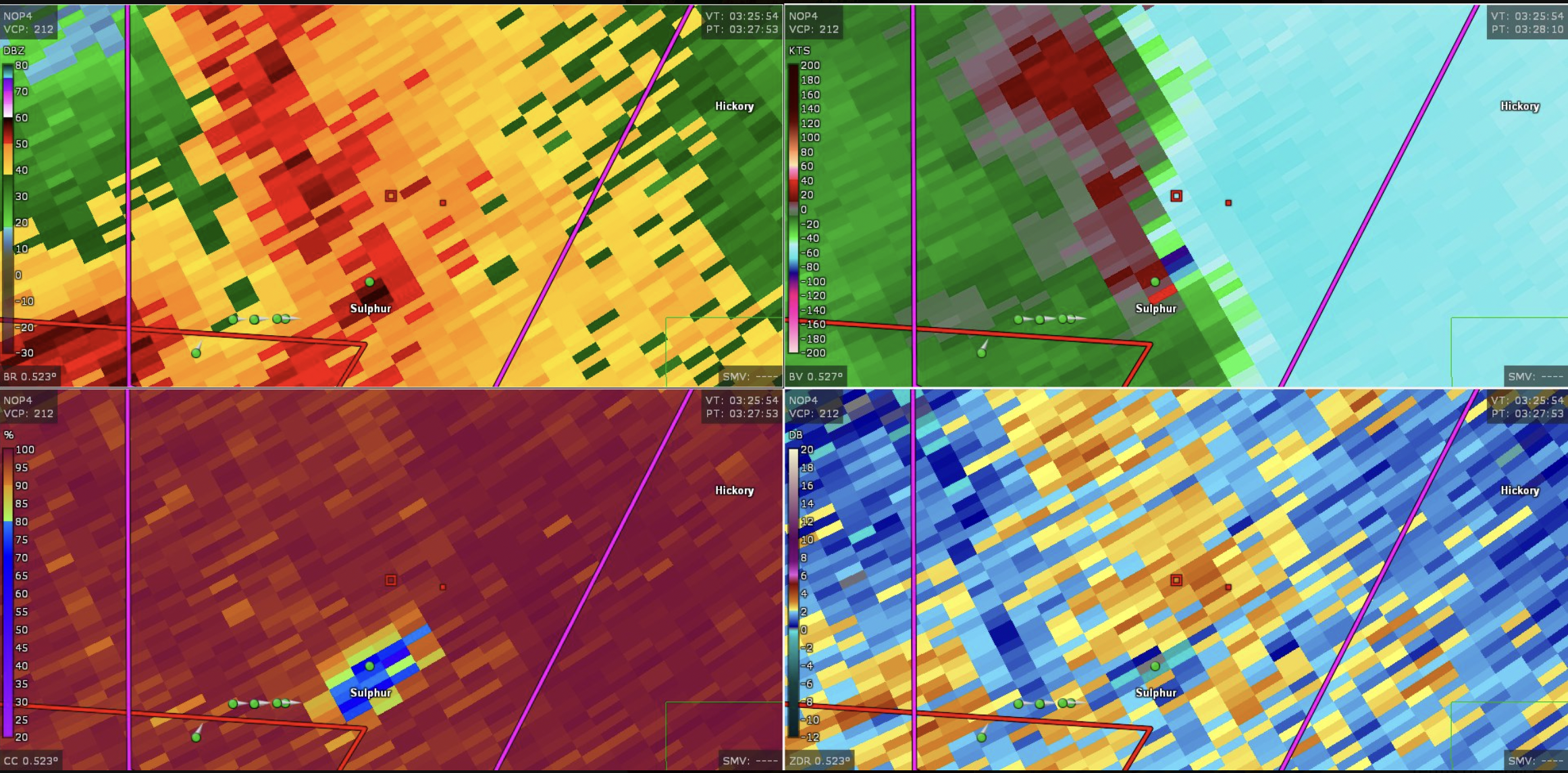
English: This image shows the radar presentation of a damaging tornado in Sulphu,r Oklahoma on April 27, 2024. |
| Dagsetning | |
| Uppruni | NEXRAD |
| Höfundarréttarhafi | National Weather Service, Federal Aviation Administration, United States Air Force |
Leyfisupplýsingar:
This image is in the public domain because it is from one or more of the U.S. government’s 159 NEXRAD radars, which are jointly owned and operated by the National Weather Service (NWS), an agency of the National Oceanic and Atmospheric Administration (NOAA) within the United States Department of Commerce, the Federal Aviation Administration (FAA) within the Department of Transportation, and the U.S. Air Force within the Department of Defense.
Thus all NEXRAD images are public domain.
|
  |
Breytingaskrá skjals
Smelltu á dagsetningu eða tímasetningu til að sjá hvernig hún leit þá út.
| Dagsetning/Tími | Smámynd | Víddir | Notandi | Athugasemd | |
|---|---|---|---|---|---|
| núverandi | 28. apríl 2024 kl. 19:44 | | 2.322 × 1.144 (5,03 MB) | Floriangkmcc | Uploaded a work by The National Weather Service from Nexrad Radar with UploadWizard |
Skráartenglar
Það eru engar síður sem nota þessa skrá.