
Mynd:Map of federal subjects of Russia (2022), disputed Crimea and Donbass.svg

Stærð þessarar PNG forskoðunar á SVG skránni: 512 × 282 mynddílar. Aðrar upplausnir: 320 × 176 mynddílar | 640 × 353 mynddílar | 1.024 × 564 mynddílar | 1.280 × 705 mynddílar | 2.560 × 1.410 mynddílar.
Upphafleg skrá (SVG-skrá, að nafni til 512 × 282 mynddílar, skráarstærð: 827 KB)
,_disputed_Crimea_and_Donbass.svg)
 This media file has been nominated for deletion since 1 maí 2024. To discuss it, please visit the nomination page.
Do not remove this tag until the deletion nomination is closed. Reason for the nomination: на даному файлі показано незаконно захоплені території АР Крим. Що являється пропагандою тероризму, а також та оправданням війни.
| |||
| |||
,_disputed_Crimea_and_Donbass.svg)
,_disputed_Crimea_and_Donbass.svg)

|
The boundaries on this map show the de facto situation. This is just one of several different views on the subject (see COM:NPOV). |
Lýsing
| Lýsing |
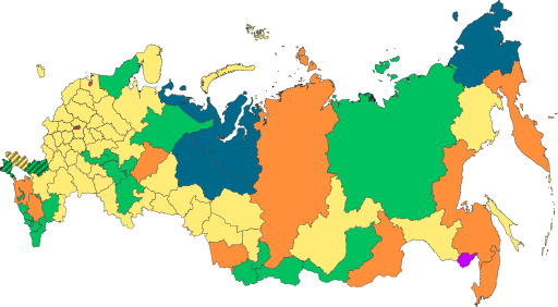
English: Copy of File:Map of federal subjects of Russia (2022).svg with disputed annexed Ukrainian territories indicated with diagonal stripes |
| Dagsetning | |
| Uppruni |
This file was derived from: Map of federal subjects of Russia 2014, disputed Crimea.svg |
| Höfundarréttarhafi | Mzajac, Ltbubbas |
.svg)
Leyfisupplýsingar:
| This map is ineligible for copyright and therefore in the public domain, because it consists entirely of information that is common property and contains no original authorship. For more information, see Commons:Threshold of originality § Maps.
|
Breytingaskrá skjals
Smelltu á dagsetningu eða tímasetningu til að sjá hvernig hún leit þá út.
| Dagsetning/Tími | Smámynd | Víddir | Notandi | Athugasemd | |
|---|---|---|---|---|---|
| núverandi | 4. október 2022 kl. 19:48 | | 512 × 282 (827 KB) | Techso01 | Uploaded a work by Mzajac, Ltbubbas from {{derived from|Map of federal subjects of Russia (2014), disputed Crimea.svg}} with UploadWizard |
Skráartenglar
Eftirfarandi síða notar þessa skrá:
Altæk notkun skráar
Eftirfarandi wikar nota einnig þessa skrá:
- Notkun á ab.wikipedia.org
- Notkun á ar.wikipedia.org
- Notkun á ast.wikipedia.org
- Notkun á be.wikipedia.org
- Notkun á cs.wikipedia.org
- Notkun á de.wikipedia.org
- Notkun á en.wikipedia.org
- Notkun á es.wikipedia.org
- Notkun á fa.wikipedia.org
- Notkun á fr.wikipedia.org
- Notkun á it.wikipedia.org
- Notkun á ja.wikipedia.org
- Notkun á ko.wikipedia.org
- Notkun á la.wikipedia.org
- Notkun á lez.wikipedia.org
- Notkun á lld.wikipedia.org
- Notkun á lt.wikipedia.org
- Notkun á lv.wikipedia.org
- Notkun á mi.wikipedia.org
- Notkun á oc.wikipedia.org
- Notkun á pt.wikipedia.org
- Notkun á ru.wikipedia.org
- Notkun á sl.wikipedia.org
- Notkun á sr.wikipedia.org
- Notkun á th.wikipedia.org
- Notkun á tly.wikipedia.org
- Notkun á tum.wikipedia.org
- Notkun á uk.wikipedia.org
- Notkun á uz.wikipedia.org
- Notkun á vi.wikipedia.org
- Notkun á vls.wikipedia.org
Skoða frekari altæka notkun þessarar skráar.
,_disputed_Crimea_and_Donbass.svg)
,_disputed_Crimea_and_Donbass.svg)