
Mynd:Map of St. Petersburg.png
Upphafleg skrá (1.011 × 999 mynddílar, skráarstærð: 608 KB, MIME-gerð: image/png)
Lýsing
| Lýsing |
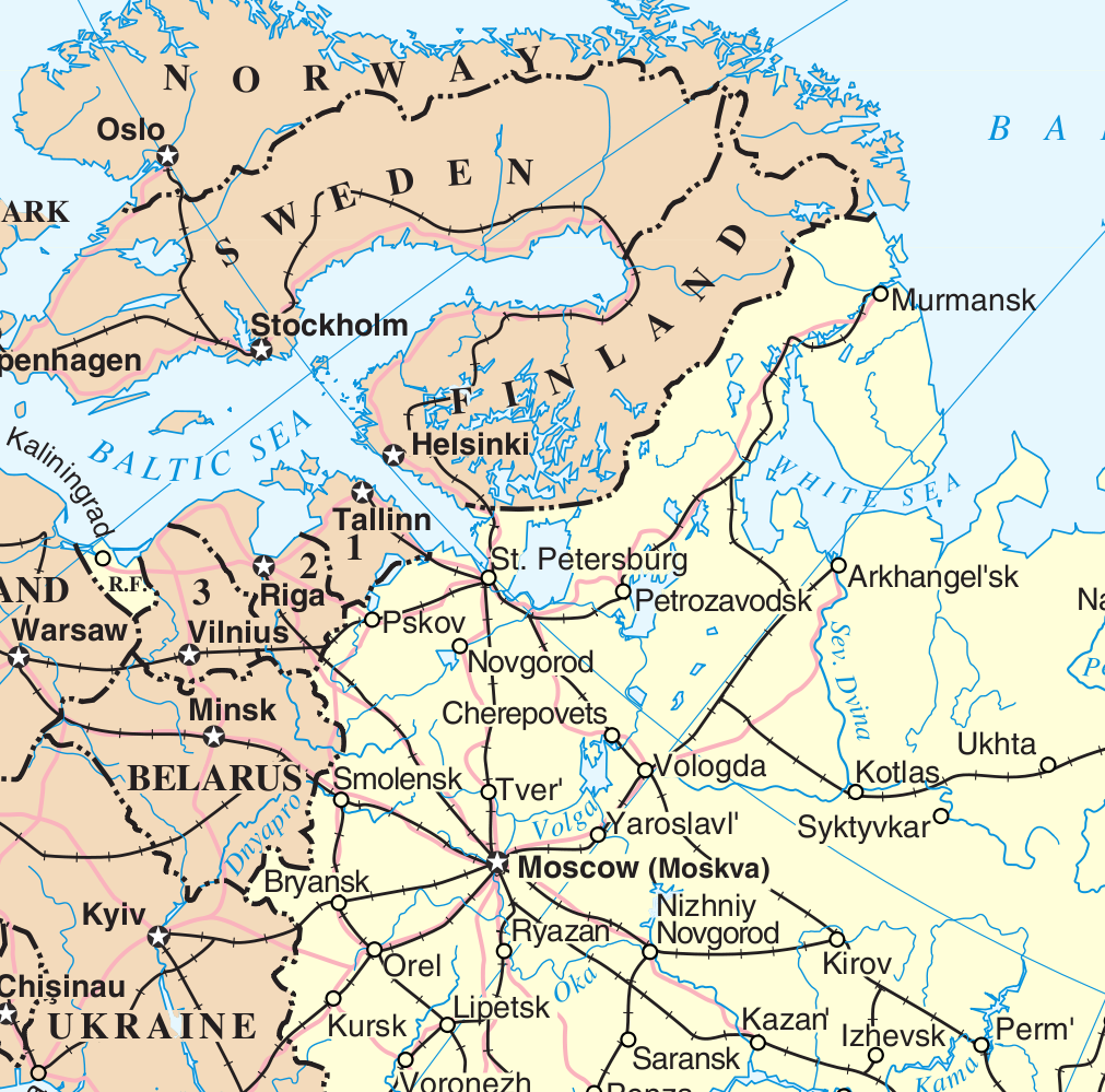
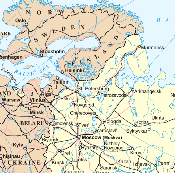
English: Map showing St. Petersburg, Russia |
| Uppruni | UN File:Un-russia.png |
| Höfundarréttarhafi | UN adapted by Dr. Blofeld |
Leyfisupplýsingar:
| This image is a map derived from a United Nations map.
Unless stated otherwise, UN maps are to be considered in the public domain. This applies worldwide. UN maps are, in principle, open source material and you can use them in your work or for making your own map. UN requests however that you delete the UN name, logo and reference number upon any modification to the map. Content of your map will be your responsibility. You can state in your publication, if you wish, something like: based on UN map … (map name, map number, revision number and date). See: Geospatial Information Section. And: Geospatial, location data for a better world. |
 |
Breytingaskrá skjals
Smelltu á dagsetningu eða tímasetningu til að sjá hvernig hún leit þá út.
| Dagsetning/Tími | Smámynd | Víddir | Notandi | Athugasemd | |
|---|---|---|---|---|---|
| núverandi | 17. júlí 2009 kl. 20:49 | | 1.011 × 999 (608 KB) | Dr. Blofeld~commonswiki | {{Information |Description={{en|1=Map showing St. Petersburg, Russia}} |Source=UN |Author=UN adapted by Dr. Blofeld |Date= |Permission= |other_versions= }} |
Skráartenglar
Eftirfarandi 2 síður nota þessa skrá:
Altæk notkun skráar
Eftirfarandi wikar nota einnig þessa skrá:
- Notkun á en.wikipedia.org
- Notkun á rm.wikipedia.org
- Notkun á sv.wikipedia.org
- Notkun á war.wikipedia.org