
Mynd:2009-11-04 20-View north from the top of the Apple Pie Hill fire tower.jpg
Stærð þessarar forskoðunar: 799 × 600 mynddílar Aðrar upplausnir: 320 × 240 mynddílar | 640 × 480 mynddílar | 818 × 614 mynddílar.
Upphafleg skrá (818 × 614 mynddílar, skráarstærð: 590 KB, MIME-gerð: image/jpeg)
| Lýsing |
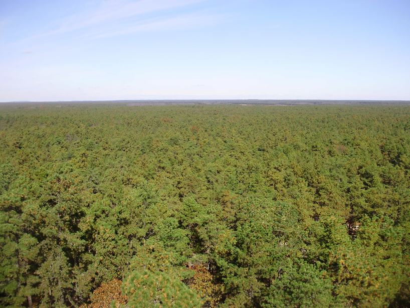
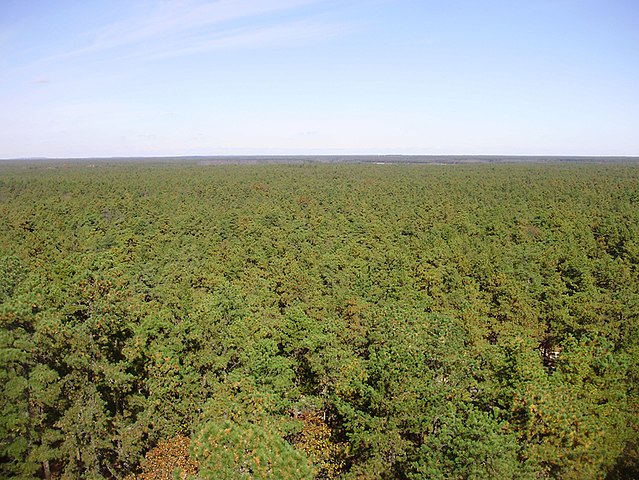
English: View north from the fire tower on Apple Pie Hill of New Jersey Pinelands National Reserve, in New Jersey.
|
| Dagsetning | (UTC) |
| Uppruni | eigin skrá (Original text: I (Famartin (talk)) created this work entirely by myself.) |
| Höfundarréttarhafi | Famartin (talk) |
| Camera location | | View this and other nearby images on: OpenStreetMap |
|---|
Leyfisupplýsingar:
Famartin at enska Wikipedia, the copyright holder of this work, hereby publishes it under the following license:
This file is licensed under the Creative Commons Attribution 3.0 Unported license.
Tilvísun höfundarréttar: Famartin at enska Wikipedia
- Þér er frjálst:
- að deila – að afrita, deila og yfirfæra verkið
- að blanda – að breyta verkinu
- Undir eftirfarandi skilmálum:
- tilvísun höfundarréttar – Þú verður að tilgreina viðurkenningu á höfundarréttindum, gefa upp tengil á notkunarleyfið og gefa til kynna ef breytingar hafa verið gerðar. Þú getur gert þetta á einhvern ásættanlegan máta, en ekki á nokkurn þann hátt sem bendi til þess að leyfisveitandinn styðji þig eða notkun þína á verkinu.
Original upload log
Transferred from en.wikipedia to Commons by Apollo1758 using CommonsHelper.
The original description page was here. All following user names refer to en.wikipedia.
- 2009-11-06 00:56 Famartin 818×614× (604328 bytes) {{Information |Description = View north from the fire tower on Apple Pie Hill on the border of [[Tabernacle Township, New Jersey|Tabernacle]] and [[Woodland Township, New Jersey|Woodland]] townships, [[Burlington County, New Jersey|Burlington County]]
Breytingaskrá skjals
Smelltu á dagsetningu eða tímasetningu til að sjá hvernig hún leit þá út.
| Dagsetning/Tími | Smámynd | Víddir | Notandi | Athugasemd | |
|---|---|---|---|---|---|
| núverandi | 30. desember 2009 kl. 20:13 | | 818 × 614 (590 KB) | Apollo1758 | {{Information |Description={{en|View north from the fire tower on Apple Pie Hill on the border of Tabernacle and Woodland townships, [[:en:Burlington County, New Jersey|Burlingt |
Skráartenglar
Eftirfarandi síða notar þessa skrá:
Altæk notkun skráar
Eftirfarandi wikar nota einnig þessa skrá:
- Notkun á en.wikipedia.org
- Notkun á en.wikivoyage.org
- Notkun á es.wikipedia.org
- Notkun á ja.wikipedia.org
- Notkun á ru.wikipedia.org
- Notkun á sr.wikipedia.org
- Notkun á uk.wikipedia.org
- Notkun á zh.wikipedia.org