
Mynd:Rakahanga.jpg
Stærð þessarar forskoðunar: 509 × 600 mynddílar Aðrar upplausnir: 204 × 240 mynddílar | 634 × 747 mynddílar.
Upphafleg skrá (634 × 747 mynddílar, skráarstærð: 131 KB, MIME-gerð: image/jpeg)
Lýsing
| Lýsing |
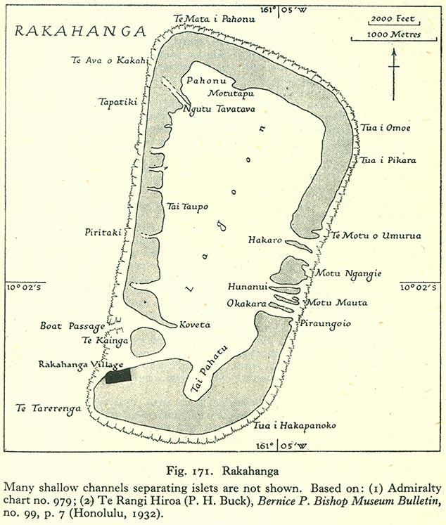
English: Map of Rakahanga Atoll, Northern Cook Islands |
| Dagsetning | |
| Uppruni | http://www.lib.utexas.edu/maps/historical/pacific_islands_1943_1945/rakahanga.jpg |
| Höfundarréttarhafi | US Army |
Leyfisupplýsingar:
This file is in the public domain because it has been taken from a collection of public domain maps at the University of Texas Library
|
Breytingaskrá skjals
Smelltu á dagsetningu eða tímasetningu til að sjá hvernig hún leit þá út.
| Dagsetning/Tími | Smámynd | Víddir | Notandi | Athugasemd | |
|---|---|---|---|---|---|
| núverandi | 10. ágúst 2008 kl. 17:19 | | 634 × 747 (131 KB) | Ratzer | {{Information |Description={{en|1=Map of Rakahanga Atoll, Northern Cook Islands}} |Source=http://www.lib.utexas.edu/maps/historical/pacific_islands_1943_1945/rakahanga.jpg |Author=US Army |Date=1943 |Permission= |other_versions= }} {{ImageUpload|full}} |
Skráartenglar
Eftirfarandi síða notar þessa skrá:
Altæk notkun skráar
Eftirfarandi wikar nota einnig þessa skrá:
- Notkun á bcl.wikipedia.org
- Notkun á ca.wikipedia.org
- Notkun á ceb.wikipedia.org
- Notkun á cs.wikipedia.org
- Notkun á de.wikipedia.org
- Notkun á en.wikipedia.org
- Notkun á es.wikipedia.org
- Notkun á fr.wikipedia.org
- Notkun á id.wikipedia.org
- Notkun á it.wikipedia.org
- Notkun á ka.wikipedia.org
- Notkun á la.wikipedia.org
- Notkun á lt.wikipedia.org
- Notkun á mt.wikipedia.org
- Notkun á ru.wikipedia.org
- Notkun á simple.wikipedia.org
- Notkun á su.wikipedia.org
- Notkun á sv.wikipedia.org
- Notkun á tr.wikipedia.org
- Notkun á www.wikidata.org