
Mynd:Norden satellite.jpg
Stærð þessarar forskoðunar: 750 × 600 mynddílar Aðrar upplausnir: 300 × 240 mynddílar | 601 × 480 mynddílar | 961 × 768 mynddílar | 1.280 × 1.023 mynddílar | 1.436 × 1.148 mynddílar.
Upphafleg skrá (1.436 × 1.148 mynddílar, skráarstærð: 977 KB, MIME-gerð: image/jpeg)
Lýsing
| Lýsing |
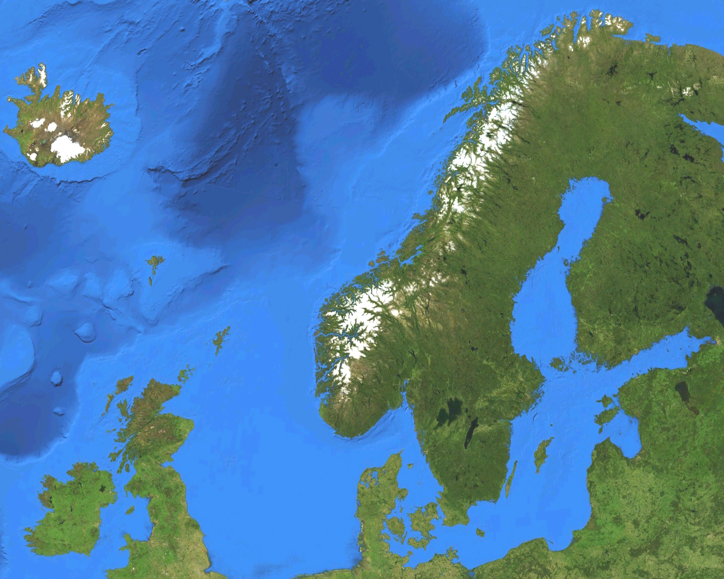
English: Satellite map of European part of the Nordic countries, except for Jan Mayen and Svalbard. Terrain and ocean topography.
Svenska: Satellitkarta över den europeiska delen av Norden, förutom Jan Mayen och Svalbard. Terräng och havstopografi. |
| Dagsetning | |
| Uppruni | Own work by uploader, made with NASA World Wind. |
| Höfundarréttarhafi | Koyos |
Leyfisupplýsingar:
| I, the copyright holder of this work, release this work into the public domain. This applies worldwide. In some countries this may not be legally possible; if so: I grant anyone the right to use this work for any purpose, without any conditions, unless such conditions are required by law. |
Breytingaskrá skjals
Smelltu á dagsetningu eða tímasetningu til að sjá hvernig hún leit þá út.
| Dagsetning/Tími | Smámynd | Víddir | Notandi | Athugasemd | |
|---|---|---|---|---|---|
| núverandi | 15. mars 2009 kl. 03:47 | | 1.436 × 1.148 (977 KB) | Koyos | colors |
| 15. mars 2009 kl. 03:30 |  | 1.444 × 1.156 (1.019 KB) | Koyos | {{Information |Description={{en|1=Satellite map of the Nordic countries. Terrain and ocean topography.}} {{sv|1=Satellitkarta över Norden. Terräng och havstopografi.}} |Source=Own work by uploader, made with NASA World Wind. |Author=Koyos |
Skráartenglar
Eftirfarandi síða notar þessa skrá:
Altæk notkun skráar
Eftirfarandi wikar nota einnig þessa skrá:
- Notkun á cs.wikipedia.org
- Notkun á el.wikipedia.org
- Notkun á en.wikipedia.org
- Notkun á eo.wikipedia.org
- Notkun á eo.wiktionary.org
- Notkun á fa.wikipedia.org
- Notkun á fr.wikipedia.org
- Notkun á he.wikipedia.org
- Notkun á he.wikiquote.org
- Notkun á id.wikipedia.org
- Notkun á lv.wikipedia.org
- Notkun á pl.wiktionary.org
- Notkun á pt.wikipedia.org
- Notkun á rm.wikipedia.org
- Notkun á sv.wikipedia.org
- Notkun á uk.wikipedia.org
- Notkun á zh.wikipedia.org