
Mynd:Mount St. Helens 05-18-1980.jpg
Upphafleg skrá (984 × 1.460 mynddílar, skráarstærð: 506 KB, MIME-gerð: image/jpeg)
Lýsing
| Lýsing |
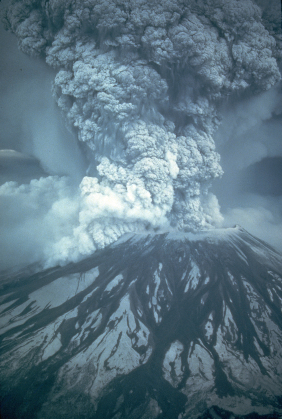
On May 18, 1980, at 8:32 a.m. Pacific Daylight Time, a magnitude 5.1 earthquake shook Mount St. Helens. The bulge and surrounding area slid away in a gigantic rockslide and debris avalanche, releasing pressure, and triggering a major pumice and ash eruption of the volcano. Thirteen-hundred feet (400 meters) of the peak collapsed or blew outwards. As a result, 24 square miles (62 square kilometers) of valley was filled by a debris avalanche, 250 square miles (650 square kilometers) of recreation, timber, and private lands were damaged by a lateral blast, and an estimated 200 million cubic yards (150 million cubic meters) of material was deposited directly by lahars (volcanic mudflows) into the river channels. Fifty-seven people were killed or are still missing. USGS Photograph taken on May 18, 1980, by Austin Post (see http://vulcan.wr.usgs.gov/Volcanoes/MSH/Images/may18_images.html). This is a cropped, smaller version of the 2048 x 3072 pixel USGS source image. |
|||||||||||||
| Dagsetning | Taken on 18. maí 1980 | |||||||||||||
| Uppruni | http://vulcan.wr.usgs.gov/Imgs/Jpg/MSH/Images/MSH80_eruption_mount_st_helens_05-18-80.jpg | |||||||||||||
| Höfundarréttarhafi |
|
|||||||||||||
| Aðrar útgáfur |
|
|||||||||||||


Leyfisupplýsingar:
This image is in the public domain in the United States because it only contains materials that originally came from the United States Geological Survey, an agency of the United States Department of the Interior. For more information, see the official USGS copyright policy.
|
Breytingaskrá skjals
Smelltu á dagsetningu eða tímasetningu til að sjá hvernig hún leit þá út.
| Dagsetning/Tími | Smámynd | Víddir | Notandi | Athugasemd | |
|---|---|---|---|---|---|
| núverandi | 11. nóvember 2007 kl. 01:49 | | 984 × 1.460 (506 KB) | WolfmanSF | I made a cropped, smaller version of the massive original image. ~~~~ |
| 11. nóvember 2007 kl. 00:24 |  | 2.048 × 3.072 (3,46 MB) | WolfmanSF | {{Information |Description=On May 18, 1980, at 8:32 a.m. Pacific Daylight Time, a magnitude 5.1 earthquake shook Mount St. Helens. The bulge and surrounding area slid away in a gigantic rockslide and debris avalanche, releasing pressure, and triggering a |
Skráartenglar
Eftirfarandi síða notar þessa skrá:
Altæk notkun skráar
Eftirfarandi wikar nota einnig þessa skrá:
- Notkun á en.wikipedia.org
- Notkun á ms.wikipedia.org
- Notkun á zh.wikipedia.org