
Mynd:Map of Argentina Demis.png
Stærð þessarar forskoðunar: 317 × 600 mynddílar Aðrar upplausnir: 127 × 240 mynddílar | 254 × 480 mynddílar | 727 × 1.375 mynddílar.
Upphafleg skrá (727 × 1.375 mynddílar, skráarstærð: 384 KB, MIME-gerð: image/png)
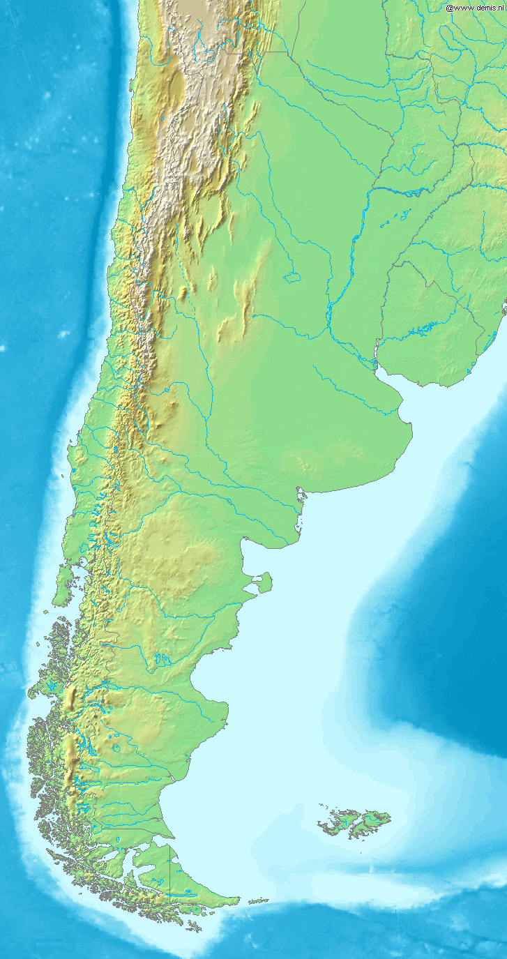
Map of Argentina
Bounding box West -77°, South -57°, East -52°, North -20°. Center at 38°30′00″S 64°30′00″W / 38.50000°S 64.50000°W.
This image is in the public domain because it came from the site https://www.demis.nl/products/web-map-server/examples/ and was released by the copyright holder. Permission is granted to copy, distribute and/or modify this map since it is based on free of copyright images from: www.demis.nl. See also approval email on de.wp and its clarification.
|
| This work has been released into the public domain by its copyright holder, www.demis.nl. This applies worldwide. In some countries this may not be legally possible; if so: www.demis.nl grants anyone the right to use this work for any purpose, without any conditions, unless such conditions are required by law.
|
Breytingaskrá skjals
Smelltu á dagsetningu eða tímasetningu til að sjá hvernig hún leit þá út.
| Dagsetning/Tími | Smámynd | Víddir | Notandi | Athugasemd | |
|---|---|---|---|---|---|
| núverandi | 20. desember 2006 kl. 19:46 | | 727 × 1.375 (384 KB) | Mats Halldin~commonswiki | Map of Argentina Bounding box West -77°, South -57°, East -52°, North -20°. Center at {{coor d|38.50000|S|64.50000|W|scale:22200000}}. {{demis-pd}} category:maps of Argentina |
Skráartenglar
Eftirfarandi síða notar þessa skrá:
Altæk notkun skráar
Eftirfarandi wikar nota einnig þessa skrá:
- Notkun á bs.wikipedia.org
- Notkun á ca.wikipedia.org
- Notkun á ckb.wikipedia.org
- Notkun á cs.wikipedia.org
- Notkun á en.wikipedia.org
- Notkun á eo.wikipedia.org
- Notkun á es.wikipedia.org
- Notkun á es.wikinews.org
- Notkun á fa.wikipedia.org
- Notkun á fi.wikipedia.org
- Notkun á fr.wikipedia.org
- Notkun á gl.wikipedia.org
- Notkun á id.wikipedia.org
- Notkun á ilo.wikipedia.org
- Notkun á it.wikipedia.org
- Notkun á ja.wikipedia.org
- Notkun á ka.wikipedia.org
- Notkun á la.wikipedia.org
- Notkun á mk.wikipedia.org
- Notkun á mr.wikipedia.org
- Notkun á nl.wikipedia.org
- Notkun á oc.wikipedia.org
- Notkun á pa.wikipedia.org
- Notkun á pnb.wikipedia.org
- Notkun á pt.wikipedia.org
- Notkun á ru.wikipedia.org
- Notkun á sh.wikipedia.org
- Notkun á sv.wikipedia.org
- Notkun á uk.wikipedia.org
- Notkun á ur.wikipedia.org
- Notkun á vi.wikipedia.org
- Notkun á xmf.wikipedia.org
- Notkun á zh-min-nan.wikipedia.org
- Notkun á zh.wikipedia.org