
Mynd:Map Bryce Canyon National Park.jpg
Stærð þessarar forskoðunar: 231 × 600 mynddílar Aðrar upplausnir: 92 × 240 mynddílar | 549 × 1.425 mynddílar.
Upphafleg skrá (549 × 1.425 mynddílar, skráarstærð: 192 KB, MIME-gerð: image/jpeg)
Deutsch: Karte des Bryce Canyon National Parks, Utah, USA
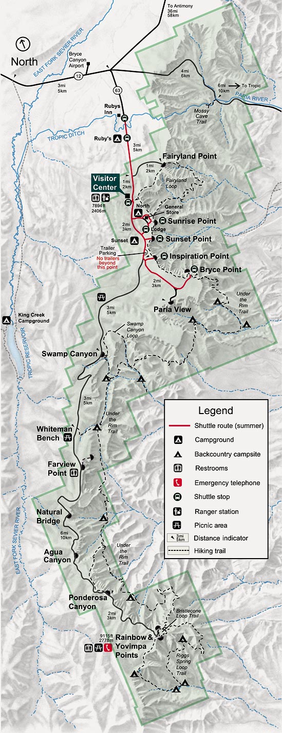
English: A road map of Bryce Canyon National Park, labelled in English, Utah, USA- The map is from [1], specifically [2]. - Presumably if the map at nps.gov is updated in the future (say, to reflect expansion of the park), this map should be overwritten with the latest version.
![[2]](http://www.nps.gov/brca/PDFs/wholemap.jpg)
Français : Carte du fr:parc national de Bryce Canyon, Utah, USA
| This image or media file contains material based on a work of a National Park Service employee, created as part of that person's official duties. As a work of the U.S. federal government, such work is in the public domain in the United States. See the NPS website and NPS copyright policy for more information. |
Breytingaskrá skjals
Smelltu á dagsetningu eða tímasetningu til að sjá hvernig hún leit þá út.
| Dagsetning/Tími | Smámynd | Víddir | Notandi | Athugasemd | |
|---|---|---|---|---|---|
| núverandi | 23. ágúst 2005 kl. 10:37 | 549 × 1.425 (192 KB) | Huebi~commonswiki | *Decription: Map of Bryce Canyon National Park *Source: National Park Service (http://www.nps.gov) *Illustrator: unknown {{PD-US}} |
Skráartenglar
Eftirfarandi síða notar þessa skrá:
Altæk notkun skráar
Eftirfarandi wikar nota einnig þessa skrá:
- Notkun á de.wikipedia.org
- Notkun á it.wikipedia.org
- Notkun á tr.wikipedia.org