
Mynd:LocationVanuatu.png
Það er engin hærri upplausn til.
LocationVanuatu.png (250 × 158 mynddílar, skráarstærð: 4 KB, MIME-gerð: image/png)

|
This locator map image could be re-created using vector graphics as an SVG file. This has several advantages; see Commons:Media for cleanup for more information. If an SVG form of this image is available, please upload it and afterwards replace this template with
{{vector version available|new image name}}.
It is recommended to name the SVG file “LocationVanuatu.svg”—then the template Vector version available (or Vva) does not need the new image name parameter. |
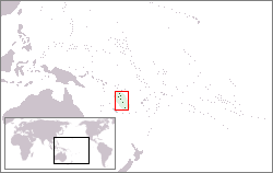
Location map for Vanuatu.
Originally created for English Wikipedia by Vardion.
| |
This work has been released into the public domain by its author, Vardion, at the enska Wikipedia project. This applies worldwide. In case this is not legally possible: |
Breytingaskrá skjals
Smelltu á dagsetningu eða tímasetningu til að sjá hvernig hún leit þá út.
| Dagsetning/Tími | Smámynd | Víddir | Notandi | Athugasemd | |
|---|---|---|---|---|---|
| núverandi | 3. september 2009 kl. 17:28 | | 250 × 158 (4 KB) | Loadmaster | Highlighted location with red rectangle. Reduced to 256-color (8-bit) color palette. |
| 19. desember 2004 kl. 19:31 |  | 250 × 158 (6 KB) | EugeneZelenko | Location map for the Vanuatu.<br/>Originally created for English Wikipedia by Vardion.<br/>{{PD}}<br/>Category:Country locator maps |
Skráartenglar
Það eru engar síður sem nota þessa skrá.
Altæk notkun skráar
Eftirfarandi wikar nota einnig þessa skrá:
- Notkun á af.wikipedia.org
- Notkun á als.wikipedia.org
- Notkun á ar.wikipedia.org
- Notkun á ban.wikipedia.org
- Notkun á be-tarask.wikipedia.org
- Notkun á bg.wikipedia.org
- Notkun á bo.wikipedia.org
- Notkun á bpy.wikipedia.org
- Notkun á br.wikipedia.org
- Notkun á bs.wikipedia.org
- Notkun á ca.wikipedia.org
- Notkun á chr.wikipedia.org
- Notkun á ckb.wikipedia.org
- Notkun á de.wikipedia.org
- Notkun á de.wikivoyage.org
- Notkun á de.wiktionary.org
- Notkun á el.wiktionary.org
- Notkun á en.wikipedia.org
- Notkun á en.wikinews.org
- Notkun á en.wikivoyage.org
- Notkun á en.wiktionary.org
- Notkun á es.wikipedia.org
- Notkun á es.wikinews.org
- Notkun á eu.wikipedia.org
- Notkun á ext.wikipedia.org
- Notkun á fa.wikipedia.org
- Notkun á fiu-vro.wikipedia.org
- Notkun á fi.wikipedia.org
- Notkun á fr.wikipedia.org
Skoða frekari altæka notkun þessarar skráar.