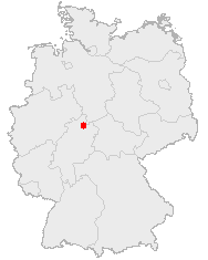
Mynd:Kassel-Position.png
Kassel-Position.png (188 × 235 mynddílar, skráarstærð: 3 KB, MIME-gerð: image/png)
Breytingaskrá skjals
Smelltu á dagsetningu eða tímasetningu til að sjá hvernig hún leit þá út.
| Dagsetning/Tími | Smámynd | Víddir | Notandi | Athugasemd | |
|---|---|---|---|---|---|
| núverandi | 26. mars 2006 kl. 13:09 |  | 188 × 235 (3 KB) | Jed | |
| 20. febrúar 2005 kl. 23:35 |  | 176 × 234 (6 KB) | ¡0-8-15! | ||
| 25. nóvember 2004 kl. 21:31 |  | 140 × 175 (14 KB) | Civvi~commonswiki | Position of Kassel in Germany |
Skráartenglar
Eftirfarandi síða notar þessa skrá:
Altæk notkun skráar
Eftirfarandi wikar nota einnig þessa skrá:
- Notkun á af.wikipedia.org
- Notkun á azb.wikipedia.org
- Notkun á de.wikinews.org
- Notkun á io.wikipedia.org
- Notkun á ja.wikipedia.org
- Notkun á lmo.wikipedia.org
- Notkun á mk.wikipedia.org
- Notkun á oc.wikipedia.org
- Notkun á pl.wikivoyage.org
- Notkun á sq.wikipedia.org
- Notkun á sv.wikinews.org
- Notkun á uk.wikipedia.org

