
Mynd:Karte esslingen in deutschland.png
Það er engin hærri upplausn til.
Karte_esslingen_in_deutschland.png (188 × 235 mynddílar, skráarstærð: 3 KB, MIME-gerð: image/png)
Lýsing
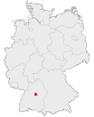
| Lýsing |
Deutsch: Karte Esslingen in deutschland |
| Dagsetning | |
| Uppruni | OpenGeoDB |
| Höfundarréttarhafi | Elinnea |
| Aðrar útgáfur | de:Bild:Karte esslingen in deutschland.png |
Leyfisupplýsingar: ==
This image was generated with OpenGeoDB. The information there is placed in the public domain, images generated from OpenGeoDB are derivative works without passing the threshold of creativity, they are therefore also public domain.
| This work is ineligible for copyright and therefore in the public domain because it consists entirely of information that is common property and contains no original authorship. |
Breytingaskrá skjals
Smelltu á dagsetningu eða tímasetningu til að sjá hvernig hún leit þá út.
| Dagsetning/Tími | Smámynd | Víddir | Notandi | Athugasemd | |
|---|---|---|---|---|---|
| núverandi | 26. mars 2006 kl. 13:25 | | 188 × 235 (3 KB) | Jed | |
| 5. september 2005 kl. 19:31 |  | 188 × 235 (6 KB) | Esco~commonswiki | transparenz & ba-wue hervorgehoben | |
| 31. ágúst 2005 kl. 12:39 |  | 188 × 235 (5 KB) | Elinnea | de:Bild:Karte esslingen in deutschland.png |
Skráartenglar
Altæk notkun skráar
Eftirfarandi wikar nota einnig þessa skrá:
- Notkun á af.wikipedia.org
- Notkun á ko.wikipedia.org
- Notkun á pl.wikivoyage.org