
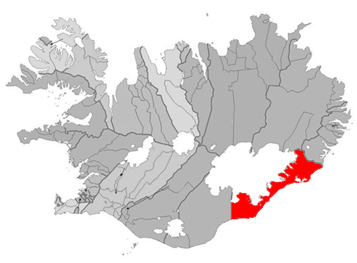
Mynd:Hornafjordur map.png
Það er engin hærri upplausn til.
Hornafjordur_map.png (507 × 373 mynddílar, skráarstærð: 115 KB, MIME-gerð: image/png)

|
This locator map image could be re-created using vector graphics as an SVG file. This has several advantages; see Commons:Media for cleanup for more information. If an SVG form of this image is available, please upload it and afterwards replace this template with
{{vector version available|new image name}}.
It is recommended to name the SVG file “Hornafjordur map.svg”—then the template Vector version available (or Vva) does not need the new image name parameter. |
Lýsing
Based on Municipalities of Iceland.png.
Leyfisupplýsingar:
| I, the copyright holder of this work, release this work into the public domain. This applies worldwide. In some countries this may not be legally possible; if so: I grant anyone the right to use this work for any purpose, without any conditions, unless such conditions are required by law. |
Breytingaskrá skjals
Smelltu á dagsetningu eða tímasetningu til að sjá hvernig hún leit þá út.
| Dagsetning/Tími | Smámynd | Víddir | Notandi | Athugasemd | |
|---|---|---|---|---|---|
| núverandi | 10. nóvember 2005 kl. 13:14 | | 507 × 373 (115 KB) | Bjarki S | Based on Image:Municipalities of Iceland.png. Category:Municipalities of Iceland |
Skráartenglar
Það eru engar síður sem nota þessa skrá.
Altæk notkun skráar
Eftirfarandi wikar nota einnig þessa skrá:
- Notkun á de.wikipedia.org
- Notkun á en.wikipedia.org
- Notkun á eo.wikipedia.org
- Notkun á es.wikipedia.org
- Notkun á fr.wikipedia.org
- Notkun á io.wikipedia.org
- Notkun á it.wikipedia.org
- Notkun á nl.wikipedia.org
- Notkun á nn.wikipedia.org
- Notkun á no.wikipedia.org
- Notkun á pl.wikipedia.org
- Notkun á sq.wikipedia.org
- Notkun á sv.wikipedia.org
- Notkun á tr.wikipedia.org
- Notkun á ur.wikipedia.org
- Notkun á www.wikidata.org