
Mynd:Grunnavík.jpg

Stærð þessarar forskoðunar: 800 × 315 mynddílar Aðrar upplausnir: 320 × 126 mynddílar | 640 × 252 mynddílar | 1.878 × 739 mynddílar.
Upphafleg skrá (1.878 × 739 mynddílar, skráarstærð: 595 KB, MIME-gerð: image/jpeg)
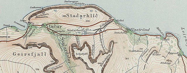
Lýsing
| Lýsing |
English: Grunnavík |
| Dagsetning | |
| Uppruni | https://myndir.islandskort.is/map/Uppdrattur_Islands___1_1_________1921_1944_38/21__Drangajokull_751/1016/2012-10-16-12-32-24.jpg |
| Höfundarréttarhafi | Geodetic Institute Copenahagen & Reykjavík 1934 |
Leyfisupplýsingar:
the copyright has certainly expired

|
The contents of this file is, in either full extent or partially, based on open public geographic data from the Danish Geodata Agency:
|
Breytingaskrá skjals
Smelltu á dagsetningu eða tímasetningu til að sjá hvernig hún leit þá út.
| Dagsetning/Tími | Smámynd | Víddir | Notandi | Athugasemd | |
|---|---|---|---|---|---|
| núverandi | 5. apríl 2021 kl. 00:40 | 1.878 × 739 (595 KB) | Xypete | Uploaded a work by Geodetic Institute Copenahagen & Reykjavík 1934 from https://myndir.islandskort.is/map/Uppdrattur_Islands___1_1_________1921_1944_38/21__Drangajokull_751/1016/2012-10-16-12-32-24.jpg with UploadWizard |
Skráartenglar
Eftirfarandi síða notar þessa skrá:
Altæk notkun skráar
Eftirfarandi wikar nota einnig þessa skrá:
- Notkun á en.wikipedia.org