
Mynd:Duisburg, Landschaftspark Duisburg-Nord, Erzbunker -- 2016 -- 1229-35.jpg

Stærð þessarar forskoðunar: 800 × 533 mynddílar Aðrar upplausnir: 320 × 213 mynddílar | 640 × 427 mynddílar | 1.024 × 683 mynddílar | 1.280 × 853 mynddílar | 2.560 × 1.707 mynddílar | 5.390 × 3.593 mynddílar.
Upphafleg skrá (5.390 × 3.593 mynddílar, skráarstærð: 11,73 MB, MIME-gerð: image/jpeg)
Lýsing
| Lýsing |
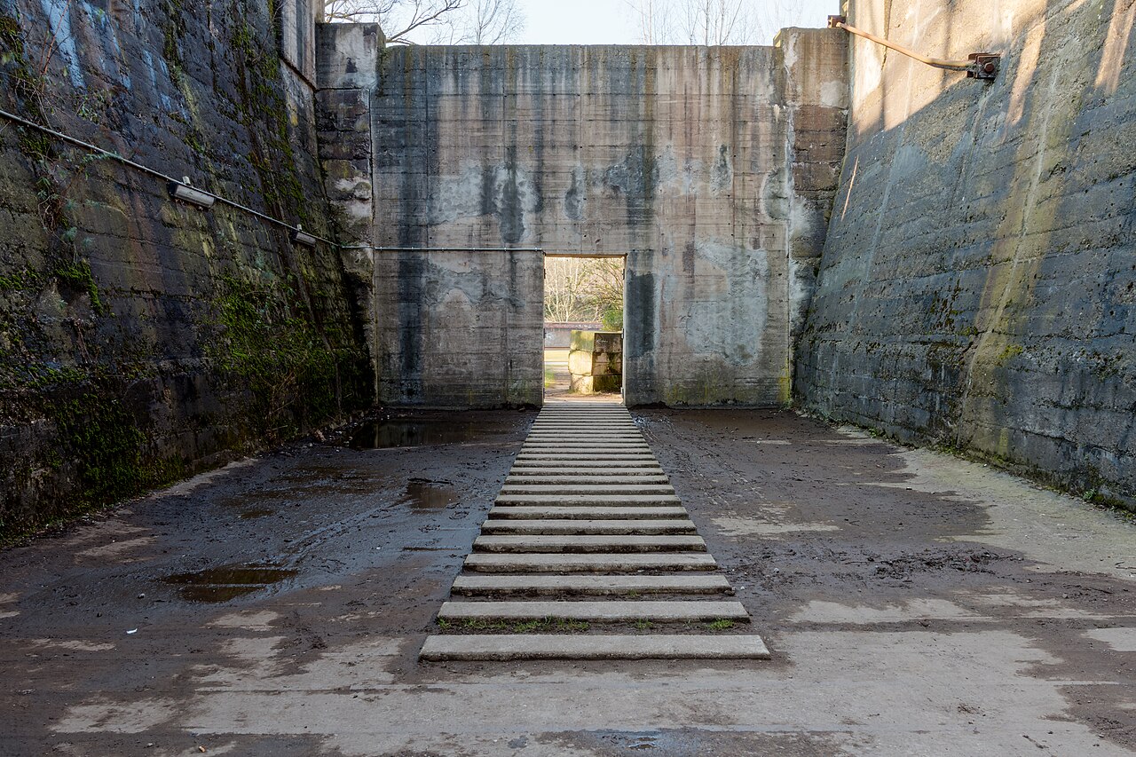
Español: Búnker de mena en Landschaftspark Duisburg-Nord, Duisburgo, Renania del Norte-Westfalia, Alemania
Français : Bunker de minerai dans le parc paysager Duisburg-Nord à Duisburg, Rhénanie-du-Nord-Westphalie, Allemagne
Magyar: Egykori érctartály a Landschaftspark Duisburg-Nord területén (Észak-Rajna-Vesztfália, Németország)
Македонски: Руднички бункери во Пределниот парк Дујсбург-Север во Дујсбург, Северна Рајна-Вестфалија, Германија
Nederlands: Ertsbunkers in het Landschaftspark Duisburg-Nord in de Duitse deelstaat Noordrijn-Westfalen
Polski: Bunkier na rudę w Parku Krajobrazowym Duisburg-Nord w Duisburgu, w Nadrenii Północnej-Westfalii, w Niemczech.
Português: Búnquer, antigamente utilizado para armazenar minério, em Landschaftspark Duisburg-Nord, Duisburgo, Renânia do Norte-Vestfália, Alemanha
Українська: Рудний бункер у ландшафтному парку Дуйсбург-Норд у Дуйсбурзі, Північний Рейн-Вестфалія, Німеччина
|
||||||||||||||||||||||||||||||||
| Staðfang |
|
||||||||||||||||||||||||||||||||
| Location | |||||||||||||||||||||||||||||||||
| Depicts | Landschaftspark Duisburg-Nord og bin | ||||||||||||||||||||||||||||||||
| Technical Specifications |
|
||||||||||||||||||||||||||||||||
| Image data |
|
||||||||||||||||||||||||||||||||
| Dagsetning | Taken on 27. febrúar 2016, 14:30 | ||||||||||||||||||||||||||||||||
| Uppruni | eigin skrá | ||||||||||||||||||||||||||||||||
| Höfundarréttarhafi |
|
||||||||||||||||||||||||||||||||
| Réttindi (Endurnotkun á þessari skrá) |
 .svg) I. Licence
This photograph is protected by copyright law. However, it may be used for free by anyone, provided it is used in accordance with the license Creative Commons License “Attribution-ShareAlike 4.0 International” (CC BY-SA 4.0). These include, among other things, the naming of the author and the license, as well as the setting of a link to the license text or its complete imprint. The attribution should be done as follows:
Please read the text of the license carefully before using the photograph. If you do not agree with the conditions of the license or if you do not understand these conditions, please refrain from using the photo. If you have any questions regarding the license or the reuse of the image, please contact me before using it. If you do not comply with the terms of the license, you do not acquire any right to use the image. If you need another license to use, please contact the author before using.
For informations about the licence see section Leyfisupplýsingar: or as human-readable summary or as full licence text at Creative Commons. In addition to the above, a link to the source - so this page with the descriptions and license terms - is appreciated. More information or examples of use can be found at re-use (with example file). The Attribution Generator is helpful in licensing matters.
As an alternative to the Creative Commons License CC BY-SA 4.0, the Free Art License (from version 1.3) may also be used.
II. Fairness
From printed materials and other tangible products that use that work, the user is asked to send a copy to the author as thank you. However, this is not a condition for the use of the photo, but a voluntary service. The mailing address can be requested via the contact options.
Please note that the author had quite considerable effort to draw up this file. Thus, it is only fair to comply with the conditions of free licenses listed here. In the case of violation of the license conditions, the rights granted hereunder will expire automatically.
III. Disclaimer
Please note that the license applies solely for the reuse of the photograph itself. The license doesn't grant you any right regarding the depicted object (eg, copyright or proprietary rights) or the personality rights of the person eventually shown. (See licences and non-copyright restrictions.) I do not grant any warranty that the subsequent use of the photograph is legally possible concerning the object or person shown in the photograph. You are responsible to check and respect these rights in the publication in the respective medium or country.
The author is not responsible for the accuracy of the information contained herein (description, title, etc.). Likewise, the author assumes no liability for further use. Please note the general disclaimer and please read reusing content outside Wikimedia too.
IV. Contact
|
||||||||||||||||||||||||||||||||
| Aðrar útgáfur |
|
||||||||||||||||||||||||||||||||
| Tilvísun höfundarréttar (required by the license) | Dietmar Rabich / Wikimedia Commons / /
|
||||||||||||||||||||||||||||||||
| Stutt URL-slóð | https://w.wiki/9ARi, https://w.wiki/_tscK (Shortlink) |
||||||||||||||||||||||||||||||||
| Keywords | Дујсбург, Северна Рајна-Вестфалија, Дуйсбург, Північний Рейн-Вестфалія, Німеччина, Alemanha, Alemania, Allemagne, Architecture, Architektur, Bauwerk, Bild des Tages, Building, Búnker, Bunker, Búnquer, Denkmal, Deutschland, Duisburg, Duisburgo, Duitsland, érc, Érc, Erts (mineraal), Erzbunker, Észak-Rajna-Vesztfália, Exzellentes Bild, Featured picture, Gebäude, Germania, Germany, Gewerbe, Gewerbe und Industrie, Handel, HDR, HDRI, HDR-Image, HDR image, High Dynamic Range Image, Industrie, Industriefotografie, Kultur, Kulturdenkmal, Kunst, Landscape, Landschaft, Landschaftspark Duisburg-Nord, LaPaDu, Meiderich-Beeck, Mena (minería), minerale, Minério, Museum, Nadrenia Północna-Westfalia, Natur, Németország, Niemcy, Noordrijn-Westfalen, Nordrhein-Westfalen, North Rhine-Westphalia, Park, Perspektive, Picture of the day, Qualitätsbild, Quality image, Renania del Norte-Westfalia, Renânia do Norte-Vestfália, Rhénanie-du-Nord-Westphalie, Ruda, Symmetrie, Symmetry impressions, Tone-mapped HDR image, Unternehmen, Wiki Loves Monuments, Wirtschaft, 2016 | ||||||||||||||||||||||||||||||||

.jpg)

| Object location | | View this and other nearby images on: OpenStreetMap |
|---|
| Camera location | | View this and other nearby images on: OpenStreetMap |
|---|
| NOTE: For this image, at least three individual images were combined as a High Dynamic Range Image (HDRI) and tone mapping (or as an exposure fusion (pseudo HDRI)) and were thereby processed digitally. Therefore, this picture may not reflect reality exactly in every detail. |

|
This image was uploaded as part of Wiki Loves Monuments 2016.
|
Assessment
|
This image was selected as picture of the day on Wikimedia Commons for 17 January 2017. It was captioned as follows: English: Ore bunkers in Landschaftspark Duisburg-Nord in Duisburg, North Rhine-Westphalia, Germany Other languages:
Deutsch: Erzbunker im Landschaftspark Duisburg-Nord in Duisburg, Nordrhein-Westfalen, Deutschland English: Ore bunkers in Landschaftspark Duisburg-Nord in Duisburg, North Rhine-Westphalia, Germany Español: Búnker de mena en Landschaftspark Duisburg-Nord, Duisburgo, Renania del Norte-Westfalia, Alemania. Magyar: Egykori érctartály a Landschaftspark Duisburg-Nord területén (Észak-Rajna-Vesztfália, Németország) Nederlands: Ertsbunkers in het Landschaftspark Duisburg-Nord in de Duitse deelstaat Noordrijn-Westfalen Polski: Bunkier na rudę w Parku Krajobrazowym Duisburg-Nord w Duisburgu, w Nadrenii Północnej-Westfalii, w Niemczech. Português: Búnquer, antigamente utilizado para armazenar minério, em Landschaftspark Duisburg-Nord, Duisburgo, Renânia do Norte-Vestfália, Alemanha. Македонски: Руднички бункери во Пределниот парк Дујсбург-Север во Дујсбург, Северна Рајна-Вестфалија, Германија. |
Leyfisupplýsingar:
Dietmar Rabich, the copyright holder of this work, hereby publishes it under the following license:
This file is licensed under the Creative Commons Attribution-Share Alike 4.0 International license.
Tilvísun höfundarréttar: Dietmar Rabich
- Þér er frjálst:
- að deila – að afrita, deila og yfirfæra verkið
- að blanda – að breyta verkinu
- Undir eftirfarandi skilmálum:
- tilvísun höfundarréttar – Þú verður að tilgreina viðurkenningu á höfundarréttindum, gefa upp tengil á notkunarleyfið og gefa til kynna ef breytingar hafa verið gerðar. Þú getur gert þetta á einhvern ásættanlegan máta, en ekki á nokkurn þann hátt sem bendi til þess að leyfisveitandinn styðji þig eða notkun þína á verkinu.
- Deila eins – Ef þú breytir, yfirfærir eða byggir á þessu efni, þá mátt þú eingöngu dreifa því verki með sama eða svipuðu leyfi og upprunalega verkið er með.
Notes
Photographs
|
You like this photograph? That pleases me very much! You would like to see more of my pictures? With pleasure.
Wikimedia Commons has a large number of my photographs available under a free license. This makes it easy for you and me. The license details are for each picture. The use is easier than you think, because in essence, this is just the attribution in the form I want. In addition, usage notes are listed for each picture. And if it does not fit, just ask. My contact information is also available with every photograph. |


Breytingaskrá skjals
Smelltu á dagsetningu eða tímasetningu til að sjá hvernig hún leit þá út.
| Dagsetning/Tími | Smámynd | Víddir | Notandi | Athugasemd | |
|---|---|---|---|---|---|
| núverandi | 24. nóvember 2016 kl. 07:11 | | 5.390 × 3.593 (11,73 MB) | XRay | resolution |
| 2. september 2016 kl. 11:15 |  | 4.608 × 3.072 (8,99 MB) | XRay | VicuñaUploader 1.23 |
Skráartenglar
Það eru engar síður sem nota þessa skrá.
Altæk notkun skráar
Eftirfarandi wikar nota einnig þessa skrá:
- Notkun á ar.wikipedia.org
- Notkun á be-tarask.wikipedia.org
- Notkun á crh.wikipedia.org
- Notkun á cv.wikipedia.org
- Notkun á de.wikipedia.org
- Notkun á en.wikipedia.org
- Notkun á hu.wikipedia.org
- Notkun á ka.wikipedia.org
- Notkun á ko.wikipedia.org
- Notkun á lbe.wikipedia.org
- Notkun á mg.wikipedia.org
- Notkun á mk.wikipedia.org
- Notkun á nl.wikipedia.org
- Notkun á os.wikipedia.org
- Notkun á pt.wikipedia.org
- Notkun á ru.wikipedia.org
- Notkun á ru.wikinews.org
- Notkun á sah.wikipedia.org
- Notkun á sq.wikipedia.org
- Notkun á tt.wikipedia.org
- Notkun á uk.wikipedia.org
- Notkun á zh.wikipedia.org