
Mynd:Arches National Park Map.jpg
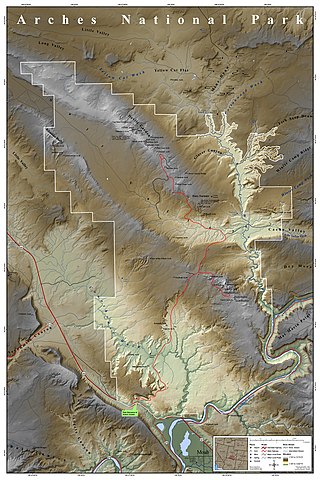
Stærð þessarar forskoðunar: 400 × 600 mynddílar Aðrar upplausnir: 160 × 240 mynddílar | 320 × 480 mynddílar | 512 × 768 mynddílar | 682 × 1.024 mynddílar | 2.500 × 3.750 mynddílar.
Upphafleg skrá (2.500 × 3.750 mynddílar, skráarstærð: 3,52 MB, MIME-gerð: image/jpeg)
|
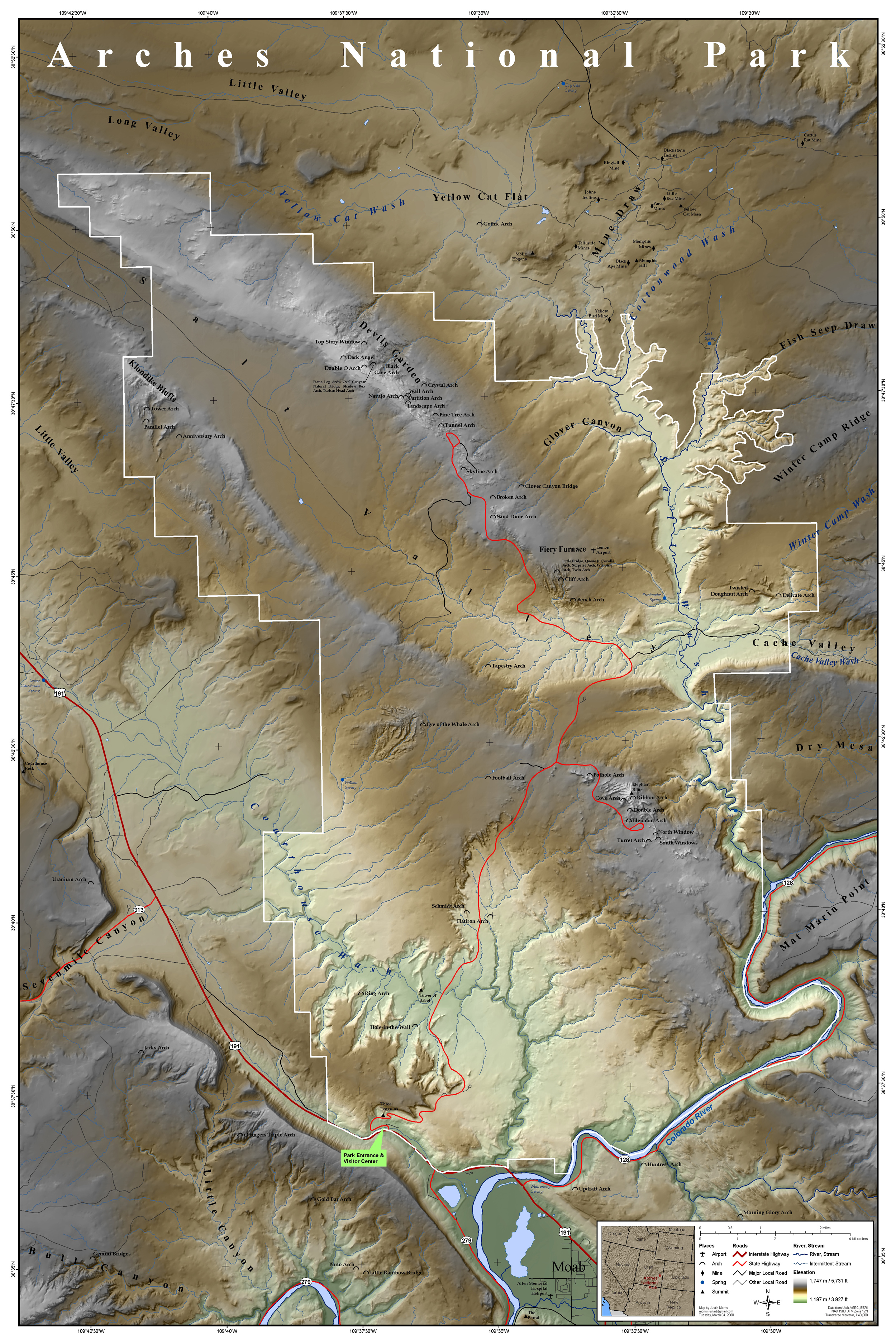
| Lýsing | Map of Arches National Park, Utah, United States showing predominant features such as arches, peaks, rivers and streams, mines, and roads. | ||
| Dagsetning | |||
| Uppruni | This map was entirely self made using ArcGIS. Map data is from Utah AGRC, ESRI and the USGS. | ||
| Höfundarréttarhafi | Justinmorris (talk) | ||
| Réttindi (Endurnotkun á þessari skrá) |
I, the copyright holder of this work, hereby publish it under the following license: Þessi skrá er með Creative Commons Tilvísun-DeilaEins 3.0 Óstaðfært notkunarleyfi.
|
Breytingaskrá skjals
Smelltu á dagsetningu eða tímasetningu til að sjá hvernig hún leit þá út.
| Dagsetning/Tími | Smámynd | Víddir | Notandi | Athugasemd | |
|---|---|---|---|---|---|
| núverandi | 16. mars 2008 kl. 17:15 | | 2.500 × 3.750 (3,52 MB) | Justinmorris | {{FeaturedPicture|Arches National Park Map}} == Summary == {{Information |Description=Map of Arches National Park, Utah, United States showing predominant features such as arches, peaks, rivers and streams, mines, and roads. |S |
Skráartenglar
Eftirfarandi síða notar þessa skrá:
Altæk notkun skráar
Eftirfarandi wikar nota einnig þessa skrá:
- Notkun á en.wikipedia.org
- Portal:Utah
- Portal:North America/Selected picture
- Portal:Utah/Featured content
- Portal:Maps/Selected picture
- User talk:Justinmorris/Archive01
- Wikipedia:Picture peer review/Archives/Jan-Mar 2008
- Wikipedia:Featured pictures thumbs/11
- Wikipedia:Featured picture candidates/March-2008
- Wikipedia:Picture peer review/Arches National Park Map
- User:Justinmorris
- Wikipedia:Featured picture candidates/Arches National Park Map
- Wikipedia:Wikipedia Signpost/2008-03-17/Features and admins
- User:Justinmorris/Maps
- Wikipedia:Featured pictures/Diagrams, drawings, and maps/Maps
- User talk:Justinmorris
- Arches National Park
- Wikipedia:Wikipedia Signpost/2008-03-17/SPV
- Wikipedia:Picture of the day/October 2008
- Template:POTD/2008-10-08
- Portal:Maps/Selected picture/39
- Portal:North America/Selected picture/32
- Wikipedia:WikiProject United States/Recognized content
- Wikipedia:WikiProject United States/Quality content
- Wikipedia:WikiProject United States/Featured pictures
- Wikipedia:Wikipedia Signpost/Single/2008-03-17
- Notkun á fr.wikipedia.org
- Notkun á he.wikipedia.org
- Notkun á kw.wikipedia.org
- Notkun á ml.wikipedia.org
- Notkun á tr.wikipedia.org
- Notkun á zh.wikipedia.org