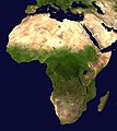
Mynd:Africa satellite orthographic.jpg

Stærð þessarar forskoðunar: 534 × 600 mynddílar Aðrar upplausnir: 214 × 240 mynddílar | 427 × 480 mynddílar | 684 × 768 mynddílar | 912 × 1.024 mynddílar | 1.624 × 1.824 mynddílar.
Upphafleg skrá (1.624 × 1.824 mynddílar, skráarstærð: 535 KB, MIME-gerð: image/jpeg)
Breytingaskrá skjals
Smelltu á dagsetningu eða tímasetningu til að sjá hvernig hún leit þá út.
| Dagsetning/Tími | Smámynd | Víddir | Notandi | Athugasemd | |
|---|---|---|---|---|---|
| núverandi | 19. apríl 2005 kl. 09:44 |  | 1.624 × 1.824 (535 KB) | Ghalas | A composed satellite photograph of Africa in orthographic projection This is NASA [http://visibleearth.nasa.gov/view_rec.php?vev1id=11656 "Blue Marble"] image applied as a texture on a sphere u |
Skráartenglar
Eftirfarandi síða notar þessa skrá:
Altæk notkun skráar
Eftirfarandi wikar nota einnig þessa skrá:
- Notkun á af.wikipedia.org
- Notkun á ang.wikipedia.org
- Notkun á ar.wikipedia.org
- Notkun á ar.wikinews.org
- Notkun á ary.wikipedia.org
- Notkun á arz.wikipedia.org
- Notkun á ast.wikipedia.org
- Notkun á as.wikipedia.org
- Notkun á awa.wikipedia.org
- Notkun á az.wikipedia.org
- Notkun á bat-smg.wikipedia.org
- Notkun á ba.wikipedia.org
- Notkun á be-tarask.wikipedia.org
- Notkun á be.wikipedia.org
- Notkun á bg.wikipedia.org
Skoða frekari altæka notkun þessarar skráar.


