
Mynd:A peat bog below the top of Doune Hill, Luss Hills, Scotland.jpg
Stærð þessarar forskoðunar: 800 × 497 mynddílar Aðrar upplausnir: 320 × 199 mynddílar | 640 × 398 mynddílar | 1.024 × 636 mynddílar | 1.280 × 796 mynddílar | 2.560 × 1.591 mynddílar | 5.472 × 3.401 mynddílar.
Upphafleg skrá (5.472 × 3.401 mynddílar, skráarstærð: 16,86 MB, MIME-gerð: image/jpeg)
Lýsing
| Lýsing |
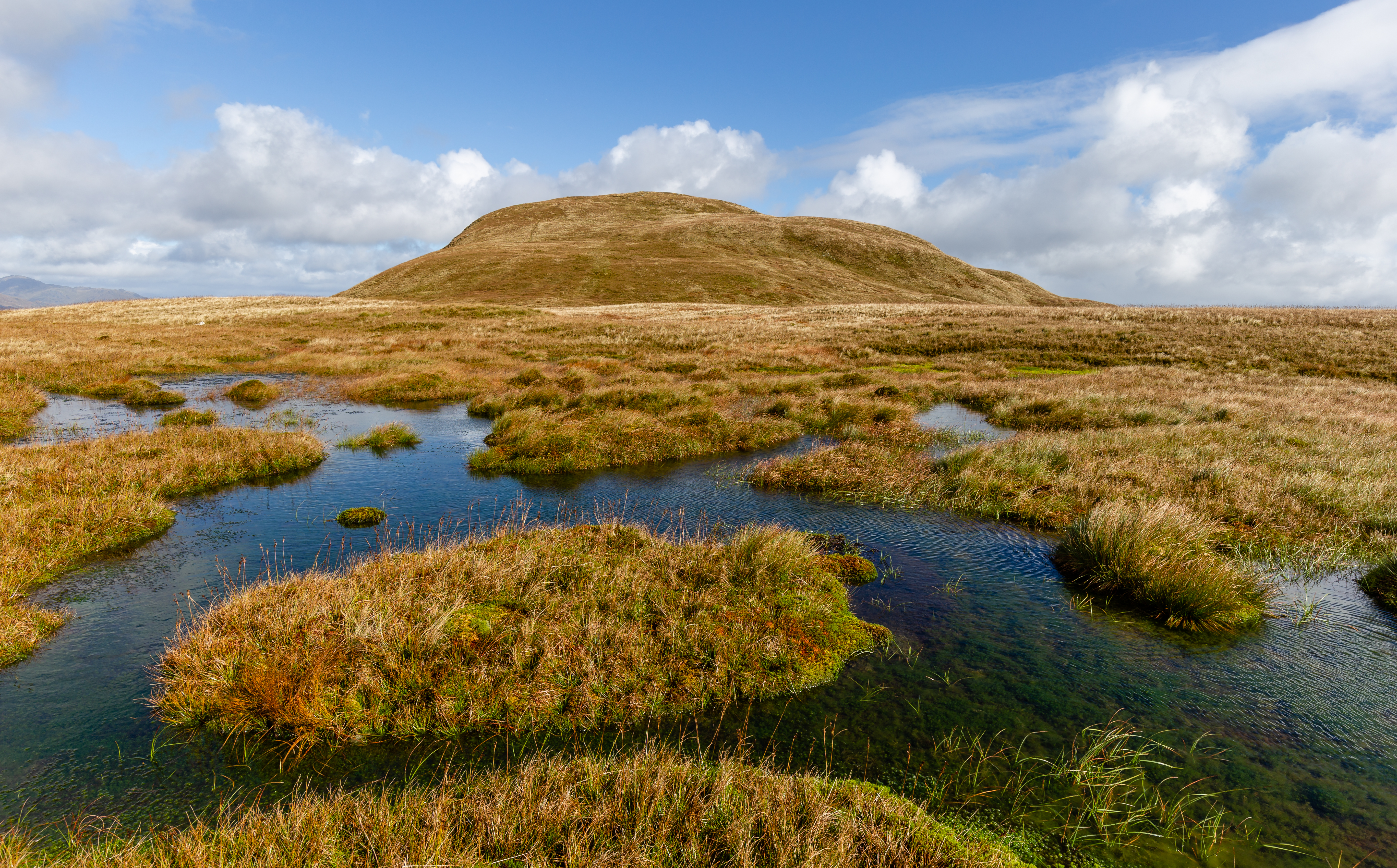
English: A peat bog below the top of Doune Hill. Luss Hills, Scotland
Français : Marais tourbeux au pied de la colline Doune. Luss Hills, Écosse
Magyar: Tőzegláp a Doune Hill alatt (Luss Hills, Skócia)
Македонски: Тресетиште на Ласките Ридови, Шкотските Гори.
Українська: Торф'яник на схилі гори Дун, місцевість Лусс-Гіллз, Шотландія |
| Dagsetning | |
| Uppruni | eigin skrá |
| Höfundarréttarhafi | Michal Klajban |
| Object location | | View this and other nearby images on: OpenStreetMap |
|---|
The production, editing or release of this file was supported by the Community-Budget of Wikimedia Deutschland. To see other files made with the support of Wikimedia Deutschland, please see the category Supported by Wikimedia Deutschland. |
Assessment
|
This image was selected as picture of the day on Wikimedia Commons for 17 June 2019. It was captioned as follows: English: A peat bog below the top of Doune Hill, Luss Hills, Scotland Other languages:
English: A peat bog below the top of Doune Hill, Luss Hills, Scotland Magyar: Tőzegláp a Doune Hill alatt (Luss Hills, Skócia) Македонски: Тресетиште на Ласките Ридови, Шкотските Гори. Українська: Торф'яник на схилі гори Дун, місцевість Лусс-Гіллз, Шотландія |
This image was selected as picture of the day on Bengali Wikipedia.
|
Leyfisupplýsingar:
I, the copyright holder of this work, hereby publish it under the following license:
This file is licensed under the Creative Commons Attribution-Share Alike 4.0 International license.
- Þér er frjálst:
- að deila – að afrita, deila og yfirfæra verkið
- að blanda – að breyta verkinu
- Undir eftirfarandi skilmálum:
- tilvísun höfundarréttar – Þú verður að tilgreina viðurkenningu á höfundarréttindum, gefa upp tengil á notkunarleyfið og gefa til kynna ef breytingar hafa verið gerðar. Þú getur gert þetta á einhvern ásættanlegan máta, en ekki á nokkurn þann hátt sem bendi til þess að leyfisveitandinn styðji þig eða notkun þína á verkinu.
- Deila eins – Ef þú breytir, yfirfærir eða byggir á þessu efni, þá mátt þú eingöngu dreifa því verki með sama eða svipuðu leyfi og upprunalega verkið er með.
Breytingaskrá skjals
Smelltu á dagsetningu eða tímasetningu til að sjá hvernig hún leit þá út.
| Dagsetning/Tími | Smámynd | Víddir | Notandi | Athugasemd | |
|---|---|---|---|---|---|
| núverandi | 3. febrúar 2019 kl. 20:23 | | 5.472 × 3.401 (16,86 MB) | Podzemnik | tilt |
| 29. janúar 2019 kl. 18:19 |  | 5.347 × 3.327 (16,48 MB) | Podzemnik | User created page with UploadWizard |
Skráartenglar
Það eru engar síður sem nota þessa skrá.
Altæk notkun skráar
Eftirfarandi wikar nota einnig þessa skrá:
- Notkun á be-tarask.wikipedia.org
- Notkun á bg.wikipedia.org
- Notkun á bn.wikipedia.org
- Notkun á crh.wikipedia.org
- Notkun á cv.wikipedia.org
- Notkun á en.wikipedia.org
- Notkun á fa.wikipedia.org
- Notkun á fr.wikipedia.org
- Notkun á fr.wiktionary.org
- Notkun á hu.wikipedia.org
- Notkun á hy.wikipedia.org
- Notkun á ka.wikipedia.org
- Notkun á ko.wikipedia.org
- Notkun á lbe.wikipedia.org
- Notkun á lez.wikipedia.org
- Notkun á mk.wikipedia.org
- Notkun á os.wikipedia.org
- Notkun á pl.wikipedia.org
- Notkun á pt.wikipedia.org
- Notkun á ru.wikipedia.org
- Notkun á ru.wikinews.org
- Notkun á sah.wikipedia.org
- Notkun á sq.wikipedia.org
- Notkun á stq.wikipedia.org
- Notkun á tr.wikipedia.org
- Notkun á tt.wikipedia.org
- Notkun á uk.wikipedia.org
- Notkun á vep.wikipedia.org