
Mynd:Western Europe Utrecht Treaty.jpg

Upphafleg skrá (1.576 × 1.257 mynddílar, skráarstærð: 388 KB, MIME-gerð: image/jpeg)
Lýsing
| Lýsing |
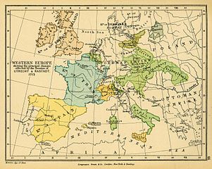
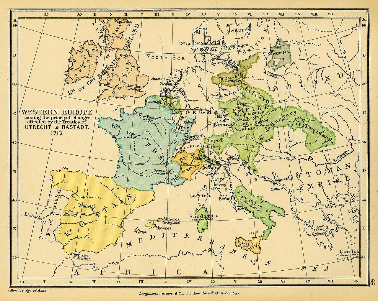
English: Map of Western Europe in 1713. |
| Dagsetning | |
| Uppruni |
|
| Höfundarréttarhafi | Charles Colbeck |
El mapa de la Pau d'Utrecht (tractat d'Utrecht) és incorrecte, ja que córsega pertany a l'imperi Austríac un cop es acceptat aquest tractat.
Hibás térkép! Magyarország 1699-ben (a karlócai békével) majdnem teljes mértékben felszabadult (teljesen csak 1718-ban, a pozsareváci békével). A térkép Kelet-Európai része az 1670-1680-as évekbeli képét mutatja.
Leyfisupplýsingar:
|
The author died in 1902, so this work is in the public domain in its country of origin and other countries and areas where the copyright term is the author's life plus 100 years or fewer. This work is in the public domain in the United States because it was published (or registered with the U.S. Copyright Office) before January 1, 1929. | |
| This file has been identified as being free of known restrictions under copyright law, including all related and neighboring rights. | |
Breytingaskrá skjals
Smelltu á dagsetningu eða tímasetningu til að sjá hvernig hún leit þá út.
| Dagsetning/Tími | Smámynd | Víddir | Notandi | Athugasemd | |
|---|---|---|---|---|---|
| núverandi | 24. nóvember 2006 kl. 16:38 | | 1.576 × 1.257 (388 KB) | Louis le Grand~commonswiki | {{Information |Beschreibung= Landkarte Europa 1713 nach dem Frieden von Utrecht |Quelle= http://www.lib.utexas.edu/maps/historical/colbeck/western_europe_utrecht_treaty.jpg |Urheber= "The Public Schools Historical Atlas" by Charles Colbeck. Longmans, Gree |
Skráartenglar
Eftirfarandi síða notar þessa skrá:
Altæk notkun skráar
Eftirfarandi wikar nota einnig þessa skrá:
- Notkun á als.wikipedia.org
- Notkun á ar.wikipedia.org
- Notkun á ast.wikipedia.org
- Notkun á bg.wikipedia.org
- Notkun á br.wikipedia.org
- Notkun á ca.wikipedia.org
- Notkun á cs.wikipedia.org
- Notkun á da.wikipedia.org
- Notkun á de.wikipedia.org
- Notkun á en.wikipedia.org
- Notkun á eo.wikipedia.org
- Notkun á eu.wikipedia.org
- Notkun á fi.wikipedia.org
- Notkun á fr.wikipedia.org
- Notkun á fr.wikiversity.org
- Notkun á he.wikipedia.org
- Notkun á hu.wikipedia.org
- Notkun á hy.wikipedia.org
- Notkun á it.wikipedia.org
- Notkun á it.wikibooks.org
- Notkun á ja.wikipedia.org
- Notkun á ka.wikipedia.org
Skoða frekari altæka notkun þessarar skráar.