
Mynd:Pomeraniae Ducatus Tabula.jpg

Stærð þessarar forskoðunar: 764 × 600 mynddílar Aðrar upplausnir: 306 × 240 mynddílar | 611 × 480 mynddílar | 978 × 768 mynddílar | 1.280 × 1.005 mynddílar | 2.560 × 2.010 mynddílar | 3.009 × 2.363 mynddílar.
Upphafleg skrá (3.009 × 2.363 mynddílar, skráarstærð: 4,85 MB, MIME-gerð: image/jpeg)
Lýsing
| Lýsing |
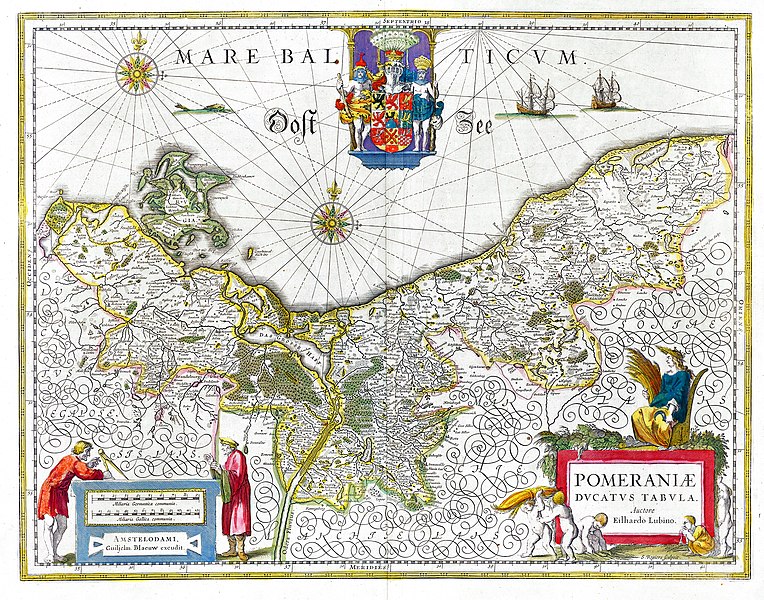
Deutsch: Karte des historischen Herzogtums Pommern aus dem 17. Jahrhundert. English: Map of the historical Duchy of Pomerania from the 17th century |
||||||||||||||||||||
| Dagsetning | |||||||||||||||||||||
| Uppruni | Willem & Joan Blaeu, Atlas Blaeu (later Atlas Maior), 1662 | ||||||||||||||||||||
| Höfundarréttarhafi |
|
||||||||||||||||||||
| Réttindi (Endurnotkun á þessari skrá) |
PD-Old | ||||||||||||||||||||
| Aðrar útgáfur | Pomeraniae Ducatus Tabula2.jpg | ||||||||||||||||||||

Leyfisupplýsingar:
|
This is a faithful photographic reproduction of a two-dimensional, public domain work of art. The work of art itself is in the public domain for the following reason:
The official position taken by the Wikimedia Foundation is that "faithful reproductions of two-dimensional public domain works of art are public domain".
This photographic reproduction is therefore also considered to be in the public domain in the United States. In other jurisdictions, re-use of this content may be restricted; see Reuse of PD-Art photographs for details. | ||||
Breytingaskrá skjals
Smelltu á dagsetningu eða tímasetningu til að sjá hvernig hún leit þá út.
| Dagsetning/Tími | Smámynd | Víddir | Notandi | Athugasemd | |
|---|---|---|---|---|---|
| núverandi | 26. september 2018 kl. 08:56 | | 3.009 × 2.363 (4,85 MB) | Gunnar.offel | * Gilb entfernt * Aufgehellt * ... |
| 16. september 2005 kl. 18:49 |  | 3.009 × 2.363 (3,09 MB) | Snufkin~commonswiki | Map of Western Pomerania (Duchy of Pomerania) from the 17th century. Author: Eilhardus Lubinus. |
Skráartenglar
Eftirfarandi síða notar þessa skrá:
Altæk notkun skráar
Eftirfarandi wikar nota einnig þessa skrá:
- Notkun á ar.wikipedia.org
- Notkun á ast.wikipedia.org
- Notkun á be.wikipedia.org
- Notkun á br.wikipedia.org
- Notkun á ca.wikipedia.org
- Notkun á csb.wikipedia.org
- Notkun á cs.wikipedia.org
- Notkun á da.wikipedia.org
- Notkun á de.wikipedia.org
- 1635
- Hinterpommern
- Siebenjähriger Krieg
- Portal:Pommern
- Geschichte Pommerns
- Schwedisch-Pommern
- Nordischer Krieg (1674–1679)
- Herzogtum Pommern
- Pommernfeldzug 1715/1716
- Eilhard Lubin
- Benutzer Diskussion:Alma/Archiv 2/2007
- Portal:Pommern/Geschichte
- Benutzer:Marcus Valerius Corvus/Nordischer Krieg
- Pommernfeldzug 1675/76
- Benutzer:Eandré/Karten
- Portal:Mecklenburg-Vorpommern/Bilderarchiv 2009
- Vertrag von Schwedt
- Wikipedia Diskussion:Hauptseite/Artikel des Tages/Archiv/Vorschläge/2016/Q2
- Wikipedia:Hauptseite/Archiv/19. April 2016
- Voigdehäger Teich
- Notkun á de.wikisource.org
- Notkun á el.wikipedia.org
- Notkun á en.wikipedia.org
- Notkun á eo.wikipedia.org
- Notkun á es.wikipedia.org
Skoða frekari altæka notkun þessarar skráar.