
Mynd:LocatieRotterdam-2010.png
Það er engin hærri upplausn til.
LocatieRotterdam-2010.png (280 × 130 mynddílar, skráarstærð: 6 KB, MIME-gerð: image/png)

|
This locator map image could be re-created using vector graphics as an SVG file. This has several advantages; see Commons:Media for cleanup for more information. If an SVG form of this image is available, please upload it and afterwards replace this template with
{{vector version available|new image name}}.
It is recommended to name the SVG file “LocatieRotterdam-2010.svg”—then the template Vector version available (or Vva) does not need the new image name parameter. |
Lýsing
| Lýsing |
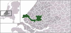
English: Map of Rotterdam: update for 2010 boundary change (addition of Rozenburg) |
| Dagsetning | (UTC) |
| Uppruni | |
| Höfundarréttarhafi |
|
Leyfisupplýsingar:
| I, the copyright holder of this work, release this work into the public domain. This applies worldwide. In some countries this may not be legally possible; if so: I grant anyone the right to use this work for any purpose, without any conditions, unless such conditions are required by law. |
Original upload log
This image is a derivative work of the following images:
- File:LocatieRotterdam.png licensed with PD-user
- 2005-06-19T00:24:29Z Andrew pmk 280x130 (5877 Bytes) pngcrush
- 2004-09-10T09:43:47Z Quistnix 280x130 (10042 Bytes) Location of Rotterdam in the Netherlands - by [[:nl:Gebruiker:Mtcv]]
Breytingaskrá skjals
Smelltu á dagsetningu eða tímasetningu til að sjá hvernig hún leit þá út.
| Dagsetning/Tími | Smámynd | Víddir | Notandi | Athugasemd | |
|---|---|---|---|---|---|
| núverandi | 22. apríl 2010 kl. 23:16 | | 280 × 130 (6 KB) | P199 | {{Information |Description={{en|Map of Rotterdam: update for 2010 boundary change (addition of Rozenburg)}} |Source=*File:LocatieRotterdam.png |Date=2010-04-22 23:13 (UTC) |Author=*File:LocatieRotterdam.png: '''Mtcv''' *derivativ |
Skráartenglar
Eftirfarandi síða notar þessa skrá:
Altæk notkun skráar
Eftirfarandi wikar nota einnig þessa skrá:
- Notkun á af.wikipedia.org
- Notkun á als.wikipedia.org
- Notkun á arz.wikipedia.org
- Notkun á ban.wikipedia.org
- Notkun á bn.wikipedia.org
- Notkun á de.wikipedia.org
- Notkun á en.wikipedia.org
- Notkun á fj.wikipedia.org
- Notkun á fr.wikipedia.org
- Notkun á id.wikipedia.org
- Notkun á li.wikipedia.org
- Notkun á mai.wikipedia.org
- Notkun á mk.wikipedia.org
- Notkun á mn.wikipedia.org
- Notkun á nl.wikipedia.org
- Notkun á sco.wikipedia.org
- Notkun á sq.wikipedia.org
- Notkun á th.wikipedia.org
- Notkun á tr.wikipedia.org
- Notkun á uk.wikipedia.org
- Notkun á ur.wikipedia.org
- Notkun á zh-min-nan.wikipedia.org
- Notkun á zh.wikipedia.org
- Notkun á zu.wikipedia.org