
Mynd:Karte der Umgebung von Kopenhagen.jpg
Stærð þessarar forskoðunar: 371 × 600 mynddílar Aðrar upplausnir: 148 × 240 mynddílar | 461 × 745 mynddílar.
Upphafleg skrá (461 × 745 mynddílar, skráarstærð: 97 KB, MIME-gerð: image/jpeg)
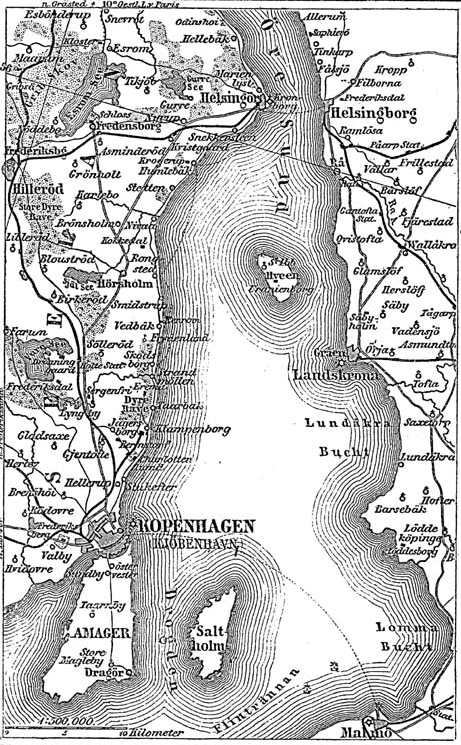
Karte des Öresund / Quelle: Meyers Konversationslexikon von 1888, Band 10, Seite 61
| This image comes from the 4th edition of Meyers Konversationslexikon (1885–90). The copyrights have expired and this image is in the public domain. |
|
This work is in the public domain in its country of origin and other countries and areas where the copyright term is the author's life plus 100 years or fewer. This work is in the public domain in the United States because it was published (or registered with the U.S. Copyright Office) before January 1, 1929. | |
| This file has been identified as being free of known restrictions under copyright law, including all related and neighboring rights. | |
derivative works
Derivative works of this file: København1888 nu bygrænse.JPG
Breytingaskrá skjals
Smelltu á dagsetningu eða tímasetningu til að sjá hvernig hún leit þá út.
| Dagsetning/Tími | Smámynd | Víddir | Notandi | Athugasemd | |
|---|---|---|---|---|---|
| núverandi | 11. desember 2004 kl. 18:29 | | 461 × 745 (97 KB) | ¡0-8-15! | {{PD-Meyers}} |
Skráartenglar
Eftirfarandi síða notar þessa skrá:
Altæk notkun skráar
Eftirfarandi wikar nota einnig þessa skrá:
- Notkun á ast.wikipedia.org
- Notkun á bg.wikipedia.org
- Notkun á cs.wikipedia.org
- Notkun á da.wikipedia.org
- Notkun á de.wikipedia.org
- Notkun á en.wikipedia.org
- Notkun á es.wikipedia.org
- Notkun á fr.wikipedia.org
- Notkun á id.wikipedia.org
- Notkun á it.wikipedia.org
- Notkun á ja.wikipedia.org
- Notkun á ko.wikipedia.org
- Notkun á ku.wikipedia.org
- Notkun á nds.wikipedia.org
- Notkun á nl.wikipedia.org
- Notkun á pt.wikipedia.org
- Notkun á ru.wikipedia.org
- Notkun á sv.wikipedia.org
- Notkun á vi.wikipedia.org
- Notkun á zh.wikipedia.org