
Mynd:Glymur pan 1-10-08.JPG

Stærð þessarar forskoðunar: 800 × 600 mynddílar Aðrar upplausnir: 320 × 240 mynddílar | 640 × 480 mynddílar | 1.024 × 768 mynddílar | 1.280 × 960 mynddílar | 2.560 × 1.920 mynddílar | 3.200 × 2.400 mynddílar.
Upphafleg skrá (3.200 × 2.400 mynddílar, skráarstærð: 5,29 MB, MIME-gerð: image/jpeg)
Lýsing
| Lýsing |
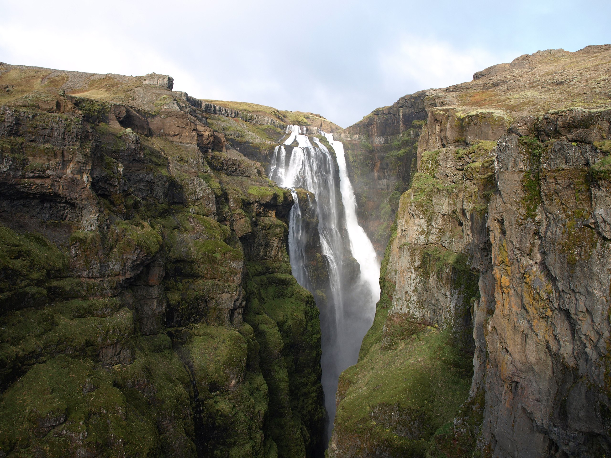
English: A pan view of Glymur, the highest waterfall in Iceland.
Íslenska: Breiðskot af Glym, hæsta foss Íslands. |
| Dagsetning | October 1rst 2008 |
| Uppruni | eigin skrá |
| Höfundarréttarhafi | Jabbi |
| Camera location | | View this and other nearby images on: OpenStreetMap |
|---|
Leyfisupplýsingar:
| I, the copyright holder of this work, release this work into the public domain. This applies worldwide. In some countries this may not be legally possible; if so: I grant anyone the right to use this work for any purpose, without any conditions, unless such conditions are required by law. |
Breytingaskrá skjals
Smelltu á dagsetningu eða tímasetningu til að sjá hvernig hún leit þá út.
| Dagsetning/Tími | Smámynd | Víddir | Notandi | Athugasemd | |
|---|---|---|---|---|---|
| núverandi | 4. október 2008 kl. 14:02 | | 3.200 × 2.400 (5,29 MB) | Jabbi | {{Information |Description={{en|1=A pan view of Glymur, the highest waterfall in Iceland.}} {{is|1=Breiðskot af Glym, hæsta foss Íslands.}} |Source=Own work by uploader |Author=Jabbi |Date=October 1rst 2008 |Permission= |other_versions= |
Skráartenglar
Eftirfarandi síða notar þessa skrá:
Altæk notkun skráar
Eftirfarandi wikar nota einnig þessa skrá:
- Notkun á arz.wikipedia.org
- Notkun á ast.wikipedia.org
- Notkun á ca.wikipedia.org
- Notkun á cs.wikipedia.org
- Notkun á de.wikipedia.org
- Notkun á es.wikipedia.org
- Notkun á fr.wikipedia.org
- Notkun á ja.wikipedia.org
- Notkun á no.wikipedia.org
- Notkun á ro.wikipedia.org
- Notkun á ru.wikipedia.org
- Notkun á tg.wikipedia.org
- Notkun á uk.wikipedia.org
- Notkun á www.wikidata.org