
Mynd:Danubemap.png
Það er engin hærri upplausn til.
Danubemap.png (747 × 480 mynddílar, skráarstærð: 601 KB, MIME-gerð: image/png)

|
This map image could be re-created using vector graphics as an SVG file. This has several advantages; see Commons:Media for cleanup for more information. If an SVG form of this image is available, please upload it and afterwards replace this template with
{{vector version available|new image name}}.
It is recommended to name the SVG file “Danubemap.svg”—then the template Vector version available (or Vva) does not need the new image name parameter. |
Lýsing
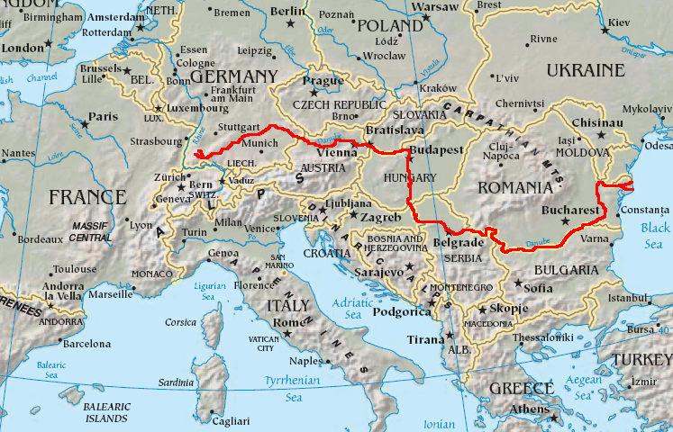
English: Map showing the flow of the Danube River. Uses the map of Europe from the CIA World Factbook.
Leyfisupplýsingar:
This image is in the public domain because it contains materials that originally came from the United States Central Intelligence Agency's World Factbook.
|
 |
Breytingaskrá skjals
Smelltu á dagsetningu eða tímasetningu til að sjá hvernig hún leit þá út.
| Dagsetning/Tími | Smámynd | Víddir | Notandi | Athugasemd | |
|---|---|---|---|---|---|
| núverandi | 12. febrúar 2007 kl. 05:34 | | 747 × 480 (601 KB) | Geologik | Map showing the flow of the Danube River. Uses the map of Europe from the CIA World Factbook. |
Skráartenglar
Eftirfarandi síða notar þessa skrá:
Altæk notkun skráar
Eftirfarandi wikar nota einnig þessa skrá:
- Notkun á ang.wikipedia.org
- Notkun á ast.wikipedia.org
- Notkun á av.wikipedia.org
- Notkun á azb.wikipedia.org
- Notkun á ban.wikipedia.org
- Notkun á be-tarask.wikipedia.org
- Notkun á bg.wikipedia.org
Skoða frekari altæka notkun þessarar skráar.